Tirinyi–Pallisa–Kamonkoli–Kumi Road
| Tirinyi–Pallisa–Kamonkoli–Kumi Road | |
|---|---|
| Route information | |
| Length | 70.1 mi (112.8 km) |
| History |
Dedication expected in 2016 Completion TBD |
| Major junctions | |
| South end | Tirinyi |
|
Pallisa Kamonkoli | |
| North end | Kumi |
| Highway system | |
| Roads in Uganda | |
The Tirinyi–Pallisa–Kamonkoli–Kumi Road is a road in the Eastern Region of Uganda, connecting the towns of Tirinyi in Kibuku District, Pallisa in Pallisa District, Kamonkoli in Budaka District, and Kumi in Kumi District.[1]
Location
From Tirinyi, the road proceeds in a general northern direction to Pallisa, a distance of approximately 22 kilometres (14 mi).[2] At Pallisa, one branch continues in a northeastern direction to Kumi, approximately 52 kilometres (32 mi) away.[3] Another branch of the road makes a southeasterly turn to Kamonkoli, a distance of approximately 54 kilometres (34 mi).[4] The total contract road distance is quoted as 112 kilometres (70 mi)[1]
Overview
The road links four districts in the Eastern Region, forming an important mode of communication in this part of the country.[5] This road is one of the 138 road projects that have seen on the to-do-list since 1986.[6]
Upgrade to tarmac
In May 2014, the government of Uganda, through the Uganda National Roads Authority, advertised for qualified contractors to bid for the improvement of this road from unimproved gravel surface to class II bitumen surface with shoulders, drainage channels, and culverts. The work is being funded jointly by the Ugandan government and the Islamic Development Bank via a loan.[5][7] The road upgrade is expected to start in 2016.[8]
See also
References
- 1 2 Emorut, Francis (7 January 2014). "Government earmarks Sh304.2 billion for Tirinyi-Pallisa-Kumi road". New Vision. Kampala. Retrieved 27 February 2016.
- ↑ GFC (27 February 2016). "Distance between Tirinyi Health Centre II, Kibuku, Eastern Region, Uganda and Pallisa, Eastern Region, Uganda". Globefeed.com (GFC). Retrieved 27 February 2016.
- ↑ GFC (27 February 2016). "Distance between Pallisa, Eastern Region, Uganda and Kumi, Eastern Region, Uganda". Globefeed.com (GFC). Retrieved 27 February 2016.
- ↑ GFC (27 February 2016). "Distance between Pallisa, Eastern Region, Uganda and Kamonkoli Health Center III, Budaka, Eastern Region, Uganda". Globefeed.com (GFC). Retrieved 27 February 2016.
- 1 2 UNRA (26 May 2014). "Civil Works for the Upgrading of Tirinyi–Pallisa–Kumi/Pallisa–Kamonkoli Roads: Invitation for Prequalification". Licitacions.accio.gencat.cat. Retrieved 27 February 2016.
- ↑ Mugerwa, Yasiin (27 February 2016). "Unfulfilled road pledges since 1986 revealed". Daily Monitor. Kampala. Retrieved 27 February 2016.
- ↑ IDB (15 May 2014). "Tenders Opportunities for Projects Financed by Islamic Development Bank: Request for Proposals-Consultancy Services for the Design and construction Supervision - The Upgrading of the Tirinyi-Palisa-Kumi/Palisa-Kamonkoli Road Project". Jeddah: Islamic Development Bank (IDB). Retrieved 27 February 2016.
- ↑ Olaka, Denis (18 December 2015). "Government To Tarmac Tirinyi-Pallisa-Kumi Road". Kampala: Uganda Radio Network. Retrieved 27 February 2016.
External links
- Uganda National Roads Authority to get $1 billion for funding new road projects
- Government Teams-up With World Bank To Build Over $1.5b Road Projects
- UNRA paves 1200km roads; 5,000km for tarmacking by 2016
Capital: Kibuku | ||
| Towns and villages | 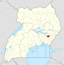 | |
| Transport | ||
| Notable people | ||
Capital: Pallisa | ||
| Towns and villages | 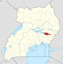 | |
| Geography |
| |
| Economy | ||
| Transport | ||
| Notable people | ||
Capital: Budaka | ||
| Counties and sub-counties |
| 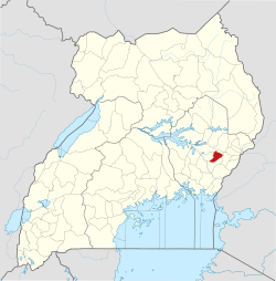 |
| Towns and villages | ||
| Economy | ||
| Banking | ||
| Transport |
| |
| Education |
| |
| Notable people | ||
Capital: Kumi | ||
| Towns and villages | 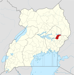 | |
| Economy | ||
| Education | ||
| Transport | ||
| Health | ||
| Notable people | ||