Iganga–Tirinyi–Kamonkoli–Mbale Road
| Iganga–Tirinyi–Kamonkoli–Mbale Road | |
|---|---|
| Route information | |
| Length | 64 mi (103 km) |
| Major junctions | |
| West end | Iganga |
|
Namutumba Tirinyi Kamonkoli | |
| East end | Mbale |
| Highway system | |
| Roads in Uganda | |
The Iganga–Tirinyi–Kamonkoli–Mbale Road, also known as the Mbale–Kamonkoli–Tirinyi–Mbale Road, is a road in the Eastern Region of Uganda, connecting the towns of Iganga in Iganga District, Namutumba in Namutumba District, Tirinyi in Kibuku District, Kamonkoli in Budaka District, and Mbale in Mbale District.
Location
The road starts at Nakalama, a suburb of Iganga, on the Jinja–Tororo Highway, approximately 44 kilometres (27 mi) east of Jinja.[1] The road proceeds in a north-easterly direction, through Namutumba,[2] Tirinyi, and Kamonkoli before ending at Mbale, a total distance of about 101 kilometres (63 mi).[3] The coordinates of the road at Tirinyi are 1°00'07.0"N, 33°45'51.0"E (Latitude: 1.001930; 33.764164).[4]
Overview
This road is an important national road, under the supervision of the Uganda National Roads Authority (UNRA).[5]
The road was upgraded to class II bitumen surface before 2001, with loan assistance from the African Development Bank.[6] Since the upgrade, the road has been plagued by recurrent surface erosion, sinkholes, and vandalis,.[7][8][9]
The government of Uganda (GOU), through UNRA, plans to fund a rehabilitation of this road. As of April 2015, the road rehabilitation project was classified as "Ongoing", fully funded by GOU.[10]
See also
References
- ↑ GFC (11 June 2016). "Distance between Jinja Town Hall, Jinja, Eastern Region, Uganda and Nakalama, Eastern Region, Uganda". Globefeed.com (GFC). Retrieved 11 June 2016.
- ↑ Oryema, Kennedy (5 May 2016). "Picture of the day: Boda boda ride along Tirinyi Road". New Vision. Uganda. Retrieved 11 June 2016.
- ↑ GFC (11 Jun 2016). "Distance between Nakalama, Eastern Region, Uganda and Mbale, Eastern Region, Uganda". Globefeed.com (GFC). Retrieved 11 Jun 2016.
- ↑ Google (11 June 2016). "Location of Iganga–Tirinyi–Kamonkoli–Mbale Road" (Map). Google Maps. Google. Retrieved 11 June 2016.
- ↑ TMN (2 November 2015). "Uganda National Roads Authourity Travel Notice - Traffic Diversion on Mbale-Tirinyi-Iganga Highway". Tendermarket.net (TMN). Retrieved 11 June 2016.
- ↑ AfDB (30 June 2001). "Uganda Road Maintenance And Upgrading Project: Project Number: P-UG-DB0-014" (PDF). Abidjan: African Development Bank (AfDB). p. 8. Retrieved 11 June 2016.
- ↑ Olupot, Milton (24 May 2010). "Uganda: Tirinyi Road Half Closed Over Stolen Culverts". New Vision via AllAfrica.com. Kampala. Retrieved 11 June 2016.
- ↑ Vision Reporter (27 October 2015). "Namatala Bridge in Pallisa caves in". New Vision. Kampala. Retrieved 11 June 2016.
- ↑ Yolisigira, Yazid (3 November 2015). "Iganga -Tirinyi Highway Closed". Daily Monitor. Kampala. Retrieved 11 June 2016.
- ↑ UNRA (27 April 2015). "UNRA: Ongoing Major Projects". Kampala: Uganda National Roads Authority (UNRA). Retrieved 11 June 2016.
External links
Coordinates: 01°00′07″N 33°45′51″E / 1.00194°N 33.76417°E
Capital: Mbale | ||
| Towns and villages | 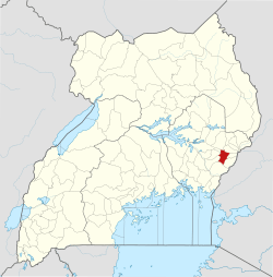 | |
| Transport | ||
| Banking |
| |
| Notable landmarks |
| |
| Education | ||
| Health | ||
| Notable people | ||
Capital: Budaka | ||
| Counties and sub-counties |
| 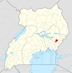 |
| Towns and villages | ||
| Economy | ||
| Banking | ||
| Transport |
| |
| Education |
| |
| Notable people | ||
Capital: Kibuku | ||
| Towns and villages | 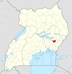 | |
| Transport | ||
| Notable people | ||
Capital: Namutumba | ||
| Towns and villages | 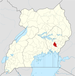 | |
| Transport | ||
| Education |
| |
| Notable people | ||
Capital: Iganga | ||
| Towns and villages |
|  |
| Transport |
| |
| Banking | ||
| Health | ||
| Education | ||
| Notable people | ||