Budaka town
| Budaka | |
|---|---|
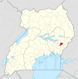
 Budaka Location in Uganda | |
| Coordinates: 01°01′00″N 33°56′42″E / 1.01667°N 33.94500°E | |
| Country |
|
| Region | Eastern Region of Uganda |
| District | Budaka District |
| Elevation | 3,810 ft (1,160 m) |
| Population (2014 Census) | |
| • Total | 23,834[1] |
Budaka is a town in the Eastern Region of Uganda. It is the chief town of Budaka District, and the district headquarters are located there.
Location
Budaka is approximately 36 kilometres (22 mi), by road, west of Mbale, the largest city in the sub-region.[2] This is approximately 212 kilometres (132 mi), by road, north-east of Kampala, the capital and largest city of Uganda.[3] The coordinates of the town are:01 01 00N, 33 56 42E (Latitude:1.0150; Longitude:33.9450).[4]
Population
The 2002 national population census estimated the town's population at 17,000. The Uganda Bureau of Statistics (UBOS) estimated the 2010 population at 21,100. In 2011, UBOS estimated the population at 21,700.[1][5]
Points of interest
The following points of interest are located within the town of Budaka or close to the edges of town:
- headquarters of Budaka District Administration
- Bugwere Primary School - enrollment 300 students
- Budaka central market
- offices of Budaka Town Council
- a mobile branch of PostBank Uganda
Naboa Sub-County was given that name by British Colonial masters because the area was full of Grammodes geometrica moths (Nziira) of the family Erebidae.
The Basimba people of the Leopard Clan with the names Katunku, Ngulya, Kaabya, Mwati, Kabolesa, Namuyonjo, Ntembe of Lupada, Naboa Sub-County, Budaka County, Budaka District live among the Bagwere but trace their origin from Tanzania and Zambia.[6]
See also
References
- 1 2 UBOS, . (27 August 2014). "The Population of The Regions of the Republic of Uganda And All Cities And Towns of More Than 15,000 Inhabitants". Citypopulation.de Quoting Uganda Bureau of Statistics (UBOS). Retrieved 21 February 2015.
- ↑ "Road Distance Between Mbale And Budaka with Map". Globefeed.com. Retrieved 29 May 2014.
- ↑ "Map Showing Kampala And Budaka With Distance Marker". Globefeed.com. Retrieved 29 May 2014.
- ↑ Google (3 July 2015). "Location of Budaka Town At Google Maps" (Map). Google Maps. Google. Retrieved 3 July 2015.
- ↑ UBOS, . "Estimated Population of Budaka In 2002, 2010 & 2011" (PDF). Uganda Bureau of Statistics (UBOS). Archived from the original (PDF) on 7 July 2014. Retrieved 17 April 2014.
- ↑ Ethnographic Survey of Africa: East Central Africa, Parts 1-4, International African Institute, 1950, p. 80
External links
Capital: Budaka | ||
| Counties and sub-counties |
|  |
| Towns and villages | ||
| Economy | ||
| Banking | ||
| Transport |
| |
| Education |
| |
| Notable people | ||