Thung Fon District
| Thung Fon ทุ่งฝน | |
|---|---|
| Amphoe | |
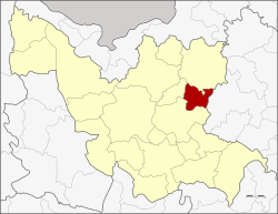 Amphoe location in Udon Thani Province | |
| Coordinates: 17°28′18″N 103°15′36″E / 17.47167°N 103.26000°ECoordinates: 17°28′18″N 103°15′36″E / 17.47167°N 103.26000°E | |
| Country | Thailand |
| Province | Udon Thani |
| Seat | Thung Fon |
| Area | |
| • Total | 227.903 km2 (87.994 sq mi) |
| Population (2005) | |
| • Total | 31,029 |
| • Density | 136.2/km2 (353/sq mi) |
| Time zone | UTC+7 (ICT) |
| Postal code | 41310 |
| Geocode | 4107 |
Thung Fon (Thai: ทุ่งฝน, pronounced [tʰûŋ fǒn]) is a district (amphoe) in the eastern part of Udon Thani Province, northeastern Thailand.
Geography
Neighboring districts are (from the south clockwise) Nong Han, Phibun Rak, Ban Dung of Udon Thani Province, Phon Phisai and Sawang Daen Din of Sakon Nakhon Province.
History
The minor district (king amphoe) Thung Fon was created on 1 July 1976, when the tambon Thung Fon and Thung Yai were split off from Nong Han District.[1] It was upgraded to a full district on 21 May 1990.[2]
Administration
The district is divided into four sub-districts (tambon), which are further subdivided into 36 villages (muban). Thung Fon is a township (thesaban tambon) which covers parts of tambon Thung Fon. There are a further four tambon administrative organizations (TAO).
| No. | Name | Thai name | Villages | Pop. | |
|---|---|---|---|---|---|
| 1. | Thung Fon | ทุ่งฝน | 12 | 12,509 | |
| 2. | Thung Yai | ทุ่งใหญ่ | 10 | 9,225 | |
| 3. | Na Chum Saeng | นาชุมแสง | 8 | 5,989 | |
| 4. | Na Thom | นาทม | 6 | 3,306 |
References
- ↑ ประกาศกระทรวงมหาดไทย เรื่อง แบ่งท้องที่อำเภอหนองหาน จังหวัดอุดรธานี ตั้งเป็นกิ่งอำเภอทุ่งฝน (PDF). Royal Gazette (in Thai). 93 (87 ง): 1637. June 29, 1976.
- ↑ พระราชกฤษฎีกาตั้งอำเภอห้วยผึ้ง อำเภอวังวิเศษ อำเภอคลองหาด อำเภอป่าบอน อำเภอหนองหญ้าปล้อง อำเภอวังโป่ง อำเภอควนเนียง อำเภอหนองหญ้าไซ อำเภอบ้านนาเดิม อำเภอทุ่งฝน อำเภอสร้างคอม และอำเภอทองแสนขัน พ.ศ. ๒๕๓๓ (PDF). Royal Gazette (in Thai). 107 (83 ก special): 1–4. May 21, 1990.
External links