Thompson Falls State Park
| Thompson Falls State Park | |
| Montana State Park | |
 Clark Fork River at Thompson Falls State Park | |
| Country | United States |
|---|---|
| State | Montana |
| County | Sanders |
| Elevation | 2,333 ft (711 m) [1] |
| Coordinates | 47°37′03″N 115°23′29″W / 47.61750°N 115.39139°WCoordinates: 47°37′03″N 115°23′29″W / 47.61750°N 115.39139°W [1] |
| Area | 36 acres (15 ha) |
| Established | 1960 [2] |
| Management | Montana Fish, Wildlife & Parks |
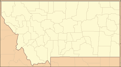 Location in Montana | |
| Website: Thompson Falls State Park | |
Thompson Falls State Park is a public recreation area occupying 36 acres (15 ha) on the banks of the Clark Fork River, one mile northwest of Thompson Falls, Montana. The state park features a boat launch, children's fishing pond, and riverside trail with mature pine forests surrounding 17 campsites, a group use area, and picnicking facilities.[3] Activities include boating, fishing, picnicking, birdwatching, and nature walks.[4] The park is fully open from spring to fall and available for walk-in day use during the rest of the year.[5]
References
- 1 2 "Thompson Falls State Recreation Area". Geographic Names Information System. United States Geological Survey.
- ↑ "Park Origin by Date". Montana State Parks. 2014. Retrieved May 28, 2018.
- ↑ "Montana State Parks Guide". Montana State Parks. 2014. p. 22. Retrieved May 28, 2018.
- ↑ "Thompson Falls State Park". Montana Office of Tourism. Retrieved May 28, 2018.
- ↑ "Thompson Falls State Park". Montana Fish, Wildlife & Parks. Retrieved September 24, 2012.
External links
- Thompson Falls State Park Montana Fish, Wildlife & Parks
| Wikimedia Commons has media related to Thompson Falls State Park. |
This article is issued from
Wikipedia.
The text is licensed under Creative Commons - Attribution - Sharealike.
Additional terms may apply for the media files.