Lost Creek State Park
| Lost Creek State Park | |
| Montana State Park | |
 Limestone cliffs | |
| Country | |
|---|---|
| State | |
| County | Deer Lodge |
| Elevation | 6,424 ft (1,958 m) [1] |
| Coordinates | 46°12′39″N 113°00′17″W / 46.21083°N 113.00472°WCoordinates: 46°12′39″N 113°00′17″W / 46.21083°N 113.00472°W [1] |
| Area | 502 acres (203 ha) |
| Established | 1957 [2] |
| Management | Montana Fish, Wildlife & Parks |
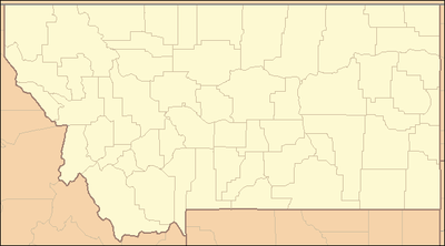 Location in Montana | |
| Website: Lost Creek State Park | |
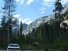
Lost Creek State Park is a public recreation area located six miles north of Anaconda, Montana, featuring limestone cliffs and multi-colored rock formations that rise 1,200 feet (370 m) above its canyon floor.The 502 acres (203 ha) state park features a short walking trail to Lost Creek Falls, which plunge 50 feet (15 m). The park is open seasonally and offers camping, fishing, picnicking, bicycling, hiking and wildlife viewing with mountain goats and bighorn sheep commonly seen.[3]
Gallery

References
- 1 2 "Lost Creek State Park". Geographic Names Information System. United States Geological Survey.
- ↑ "Park Origin by Date". Montana State Parks. 2014. Retrieved June 13, 2018.
- ↑ "Lost Creek State Park". Montana Fish, Wildlife and Parks. Retrieved September 19, 2012.
External links
- Lost Creek State Park Montana Fish, Wildlife & Parks
- Lost Creek State Park Trail Map Montana Fish, Wildlife & Parks
| Wikimedia Commons has media related to Lost Creek State Park. |
This article is issued from
Wikipedia.
The text is licensed under Creative Commons - Attribution - Sharealike.
Additional terms may apply for the media files.