Thokarpa
| Thokarpa ठोकर्पा | |
|---|---|
| Village development committee | |
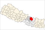
 Thokarpa Location in Nepal | |
| Coordinates: 27°41′N 85°47′E / 27.68°N 85.79°ECoordinates: 27°41′N 85°47′E / 27.68°N 85.79°E | |
| Country |
|
| Zone | Bagmati Zone |
| District | Sindhupalchok District |
| Population (2013) | |
| • Total | 6,243 |
| • Religions | Hindu |
| Time zone | UTC+5:45 (Nepal Time) |
Thokarpa is a village in Sindhupalchok District in the Bagmati Zone of central Nepal. At the time of the 2013 Nepal census it had a population of 6,243 and had 1,047 houses in it.[1]
References
- ↑ "Nepal Census 2001". Nepal's Village Development Committees. Digital Himalaya. Retrieved 2008-08-24.
Popular Villages in Thokarpa
Thokarpa is a village development committee with many sattlements. Gairigaun, Guthigaun, Kotgaun, Bhalukharka, Jamune, Tinghare, Dandakateri, Mulkharka, Chinde, Gaire, Ghartigaun, Mane, Bhanjyang,Titre, Simle, Kafle, Laharetol, etc are the popular villages.
Newly,after starting the Chehere Thokarpa road. 12 Kilo became a hub of some village of Kavrepalanchok district and eastern settlements of Thokarpa VDC.Today there is road from sukute to different part of this village.
This article is issued from
Wikipedia.
The text is licensed under Creative Commons - Attribution - Sharealike.
Additional terms may apply for the media files.