Atarpur
| Atarpur अत्तरपुर wad 1 | |
|---|---|
| Village development committee | |
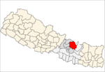
 Atarpur Location in Nepal | |
| Coordinates: 27°41′N 85°54′E / 27.68°N 85.90°ECoordinates: 27°41′N 85°54′E / 27.68°N 85.90°E | |
| Country |
|
| Zone | Bagmati Zone |
| District | Sindhupalchok District |
| Population (1991) | |
| • Total | 2,008 |
| • Religions | Hindu |
| Time zone | UTC+5:45 (Nepal Time) |
Atarpur is a village in Sindhupalchok District in the Bagmati Zone of central Nepal. At the time of the 1991 Nepal census it had a population of 2008 and had 394 houses in the village.[1]
References
- ↑ "Nepal Census 2001". Nepal's Village Development Committees. Digital Himalaya. Archived from the original on 2008-10-12. Retrieved 2008-08-24.
This article is issued from
Wikipedia.
The text is licensed under Creative Commons - Attribution - Sharealike.
Additional terms may apply for the media files.