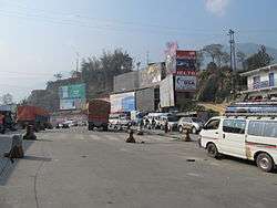
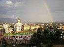
Thankot
| Thankot थानकोट shonitpur | |
|---|---|
| Village of Chandragiri Municipality | |
 | |
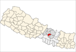
 Thankot Location in Nepal | |
| Coordinates: 27°41′N 85°11′E / 27.683°N 85.183°ECoordinates: 27°41′N 85°11′E / 27.683°N 85.183°E | |
| Country |
|
| Province | No. 3 |
| District | Kathmandu District |
| Population (2011) | |
| • Total | 12,047 |
| Time zone | UTC+5:45 (Nepal Time) |
| Postal code | 44619 |
| Area code(s) | 01 |
Thankot is a village and former Village Development Committee that is now part of Chandragiri Municipality in Kathmandu District in Province No. 3 of central Nepal. It lies on the lap of Chandragiri hill. According to the 2011 Nepal census it has a population of 12047 and has 2820 households.[1]
Some of the important places in thankot are 'Tribhuwan park', 'Narayan temple', 'Mahalaxmi Temple','Chadragiri hill'. [2]
References
- ↑ "Nepal Census 2001". Nepal's Village Development Committees. Digital Himalaya. Retrieved 2008-08-28.
- ↑ "National Population and Housing Census 2011" (PDF). Government of Nepal, National Planning Commission Secretariat, Central Bureau of Statistics. Archived from the original (PDF) on 2013-07-31. Retrieved November 2012. Check date values in:
|accessdate=(help)
Headquarter: Kathmandu | |||
 |  | ||
This article is issued from
Wikipedia.
The text is licensed under Creative Commons - Attribution - Sharealike.
Additional terms may apply for the media files.