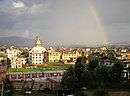
Nagarjun Municipality
| Nagarjun Municipality नागार्जुन नगरपालिका | |
|---|---|
| Municipality | |
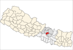
 Nagarjun Municipality Location in Nepal | |
| Coordinates: 27°43′57″N 85°15′24″E / 27.73250°N 85.25667°ECoordinates: 27°43′57″N 85°15′24″E / 27.73250°N 85.25667°E | |
| Country |
|
| Province | Province No. 3 |
| District | Kathmandu |
| Established | December 2014 |
| Government | |
| • Mayor | Mohan Basnet (NC) |
| • Deputy Mayor | Sushila Adhikari (NCP) |
| Area | |
| • Total | 29.8 km2 (11.5 sq mi) |
| Population (2011 Nepal census) | |
| • Total | 67,420 |
| • Density | 2,300/km2 (5,900/sq mi) |
| • Ethnicities | Newar, Bahun, Chhetri, Tamang, Magar |
| Time zone | UTC+5:45 (Nepal Time) |
| Website |
www |
Nagarjun is a municipality in Kathmandu District in the Province No. 3 of Nepal that was established on 2 December 2014 by merging the former Village development committees Bhimdhunga, Ichangu Narayan, Ramkot, Syuchatar and Sitapaila.[1][2] The office of the municipality is located at Harisiddhi Sitapaila. Previously there were 14 wards in the municipality. After implementation of federalism, it has been now decreased to 10 wards.
Population
Nagarjun municipality has a total population of 67,420 according to 2011 Nepal census.[3]
References
- ↑ "Govt announces 61 municipalities". The Kathmandu Post. 3 December 2014. Retrieved 2 December 2014.
- ↑ "Govt creates 61 new municipalities". República. 3 Dec 2014. Retrieved 2 Dec 2014.
- ↑ "2011 Nepal census (Ward Level)" (PDF). Central Bureau of Statistics. November 2012. Archived from the original (PDF) on November 2013.
External links
This article is issued from
Wikipedia.
The text is licensed under Creative Commons - Attribution - Sharealike.
Additional terms may apply for the media files.