Thèze, Alpes-de-Haute-Provence
| Thèze | ||
|---|---|---|
| Commune | ||
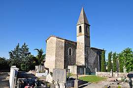 Thèze, church and cemetery | ||
| ||
 Thèze Location within Provence-A.-C.d'A. region  Thèze | ||
| Coordinates: 44°19′10″N 5°55′19″E / 44.3194°N 5.9219°ECoordinates: 44°19′10″N 5°55′19″E / 44.3194°N 5.9219°E | ||
| Country | France | |
| Region | Provence-Alpes-Côte d'Azur | |
| Department | Alpes-de-Haute-Provence | |
| Arrondissement | Forcalquier | |
| Canton | Seyne | |
| Government | ||
| • Mayor (2014–2020) | Gérard Dubuisson | |
| Area1 | 11.17 km2 (4.31 sq mi) | |
| Population (2008)2 | 205 | |
| • Density | 18/km2 (48/sq mi) | |
| Time zone | UTC+1 (CET) | |
| • Summer (DST) | UTC+2 (CEST) | |
| INSEE/Postal code | 04216 /04200 | |
| Elevation | 492–728 m (1,614–2,388 ft) | |
|
1 French Land Register data, which excludes lakes, ponds, glaciers > 1 km2 (0.386 sq mi or 247 acres) and river estuaries. 2 Population without double counting: residents of multiple communes (e.g., students and military personnel) only counted once. | ||

Thèze is a commune in the Alpes-de-Haute-Provence department in southeastern France.
Population
| Historical population | ||
|---|---|---|
| Year | Pop. | ±% |
| 1765 | 366 | — |
| 1793 | 397 | +8.5% |
| 1800 | 393 | −1.0% |
| 1806 | 360 | −8.4% |
| 1821 | 326 | −9.4% |
| 1831 | 404 | +23.9% |
| 1836 | 396 | −2.0% |
| 1841 | 406 | +2.5% |
| 1846 | 356 | −12.3% |
| 1851 | 317 | −11.0% |
| 1856 | 297 | −6.3% |
| 1861 | 331 | +11.4% |
| 1866 | 340 | +2.7% |
| 1872 | 323 | −5.0% |
| 1876 | 277 | −14.2% |
| 1881 | 274 | −1.1% |
| 1886 | 278 | +1.5% |
| 1891 | 260 | −6.5% |
| 1896 | 276 | +6.2% |
| 1901 | 282 | +2.2% |
| 1906 | 247 | −12.4% |
| 1911 | 242 | −2.0% |
| 1921 | 210 | −13.2% |
| 1926 | 193 | −8.1% |
| 1931 | 175 | −9.3% |
| 1936 | 173 | −1.1% |
| 1946 | 164 | −5.2% |
| 1954 | 139 | −15.2% |
| 1962 | 145 | +4.3% |
| 1968 | 128 | −11.7% |
| 1975 | 105 | −18.0% |
| 1982 | 119 | +13.3% |
| 1990 | 130 | +9.2% |
| 1999 | 144 | +10.8% |
| 2008 | 205 | +42.4% |
See also
References
| Wikimedia Commons has media related to Thèze, Alpes-de-Haute-Provence. |
This article is issued from
Wikipedia.
The text is licensed under Creative Commons - Attribution - Sharealike.
Additional terms may apply for the media files.