Taviet
| Taviet | |
|---|---|
| Coordinates: 50°16′04″N 5°01′05″E / 50.267644°N 5.018125°E | |
| Country | Belgium |
| Community | French Community of Belgium |
| Regions of Belgium |
|
| Province of Belgium |
|
| Area | |
| • Total | 7.13 km2 (2.75 sq mi) |
| Elevation | 237 m (778 ft) |
| Time zone | UTC+2 |
| Website |
www |
Taviet is a commune in Dinant, Wallonia region of Belgium.[1]
It was part of Achene until it consolidated with Dinant in 1977.
History
9 km from Dinant, 5 from Ciney, Taviet is a former hamlet of Achêne spent in the entity of Dinant during the mergers of 1977. Established on the hilly slope of the stream of Leffe, this village is located along a loop road surrounding the church planted on a summit. Composed of houses and small farms adjoining the eighteenth and nineteenth centuries, the village stretches softly towards the bottom of the valley occupied by a large farm and the mill. On the top of Taviet, the castle dominates.
Castle
The castle is located in a large hilly and wooded park, formerly partially surrounded by moat filled. Today, the castle of Taviet brick and limestone basement was almost completely rebuilt during the last quarter of the nineteenth century (1882-1900), all due to a "romantic" perspective by the Baron d'Huart. New work was done by architect Bonaert around 1960, giving it a more classic appearance.
Originally, it was a dungeon built in the fourteenth century, some testimonies (arquebusières, murderers) remain. Today, it is owned by the family Le Hardy de Baulieu.
References
- ↑ CDSI. "Taviet - Ville de Dinant". www.dinant.be (in French). Retrieved 2018-10-08.
| Dinant | 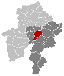 | |
|---|---|---|
| Sections | Anseremme · Bouvignes · · Dréhance · Falmagne · Falmignoul · Foy-Notre-Dame · Furfoox · Lisogne · Sorinnes · Thynes | |
| Hamlets | ||