Tassajara Hot Springs, California
| Tassajara Hot Springs | |
|---|---|
| Unincorporated community | |
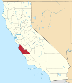
 Tassajara Hot Springs Location in California  Tassajara Hot Springs Tassajara Hot Springs (the US) | |
| Coordinates: 36°14′03″N 121°32′56″W / 36.23417°N 121.54889°WCoordinates: 36°14′03″N 121°32′56″W / 36.23417°N 121.54889°W | |
| Country | United States |
| State | California |
| County | Monterey County |
| Elevation[1] | 1,637 ft (499 m) |
Tassajara Hot Springs (formerly, Tassajara)[2] is an unincorporated community in Monterey County, California,[1] located 9 miles (14 km) east-northeast of Partington Point,[2] at an elevation of 1637 feet (499 m).[1]
The Tassajara post office operated from 1892 to 1894[2] followed by the Tassajara Hot Springs Post Office, which was open from 1912 until 1944.[2] A hotel was built at the site between 1893–1894 and the (Tassajara Hot Springs) resort established at one of the 17 or so natural hot springs in the area.[2] The name comes from Native American or Mexican and means "the place where meat is cured by drying".[2]
Government
At the county level, Tassajara Hot Springs is represented on the Monterey County Board of Supervisors by Supervisor Dave Potter.[3]
In the California State Legislature, Tassajara Hot Springs is in the 17th Senate District, represented by Democrat Bill Monning, and in the 30th Assembly District, represented by Democrat Anna Caballero.[4]
In the United States House of Representatives, Tassajara Hot Springs is in California's 20th congressional district, represented by Democrat Jimmy Panetta[5]
References
- 1 2 3 U.S. Geological Survey Geographic Names Information System: Tassajara Hot Springs, California
- 1 2 3 4 5 6 Durham, David L. (1998). California's Geographic Names: A Gazetteer of Historic and Modern Names of the State. Clovis, Calif.: Word Dancer Press. p. 966. ISBN 1-884995-14-4.
- ↑ "Monterey County Supervisorial District 5 Map (North District 5)" (PDF). County of Monterey. Archived from the original (PDF) on 1 July 2012. Retrieved 21 September 2012.
- ↑ "Statewide Database". UC Regents. Retrieved February 11, 2015.
- ↑ "California's 20th Congressional District - Representatives & District Map". Civic Impulse, LLC. Retrieved September 24, 2014.