Neponset, California
| Neponset | |
|---|---|
| Unincorporated community | |
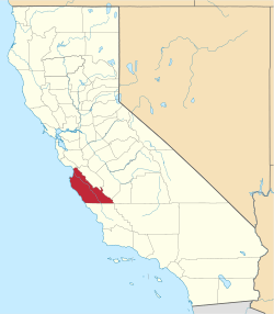
 Neponset Location in California  Neponset Neponset (the US) | |
| Coordinates: 36°43′43″N 121°47′04″W / 36.72861°N 121.78444°WCoordinates: 36°43′43″N 121°47′04″W / 36.72861°N 121.78444°W | |
| Country | United States |
| State | California |
| County | Monterey County |
| Elevation[1] | 23 ft (7 m) |
Neponset (until 1900, Martin Station)[2] is an unincorporated community in Monterey County, California.[1] It is located on the Southern Pacific Railroad and California State Route 1 between Marina and Castroville, and 8.5 miles (14 km) west-northwest of Salinas,[2] at an elevation of 23 feet (7 m).[1]
The town is named after Neponset, Massachusetts.[2]
References
This article is issued from
Wikipedia.
The text is licensed under Creative Commons - Attribution - Sharealike.
Additional terms may apply for the media files.