Tamano
| Tamano 玉野市 | |||
|---|---|---|---|
| City | |||
_crossing_at_Tamano%2C_Okayama.JPG) Crossing in Tamano City | |||
| |||
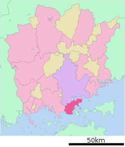 Location of Tamano in Okayama Prefecture | |||
 Tamano Location in Japan | |||
| Coordinates: 34°29′19″N 133°56′55″E / 34.48861°N 133.94861°ECoordinates: 34°29′19″N 133°56′55″E / 34.48861°N 133.94861°E | |||
| Country | Japan | ||
| Region | Chūgoku (San'yō) | ||
| Prefecture | Okayama Prefecture | ||
| Government | |||
| • Mayor | Susumu Kuroda (since October 2005) | ||
| Area | |||
| • Total | 103.61 km2 (40.00 sq mi) | ||
| Population (October 1, 2016) | |||
| • Total | 60,101 | ||
| • Density | 580/km2 (1,500/sq mi) | ||
| Symbols | |||
| • Tree | Quercus | ||
| • Flower | Azalea | ||
| • Fish | Sabastes (Mebaru in Japanese) | ||
| Time zone | UTC+9 (JST) | ||
| City hall address |
Uno 1-27-1, Tamano City, Okayama Prefecture (岡山県玉野市宇野1丁目27番1号) 706-8510 | ||
| Website |
www | ||


Tamano (玉野市 Tamano-shi) is a city located in southern Okayama Prefecture, Japan. The city was officially founded on August 3, 1940.
As of October 1, 2016, the city has an estimated population of 60,101 and a population density of 580 persons per km². The total area is 103.61 km².
JR Uno Line connects it to Okayama. Before the Great Seto Bridge was opened, there was a train ferry between Uno Port in Tamano and Takamatsu on Shikoku and Tamano was the major entrance to Shikoku. Still today there are many ferry lines between Uno port and Takamatsu, Shodoshima and Naoshima Islands.
Its major industry is ship construction and metal refining. Another major industry is fishing. Mitsui Engineering & Shipbuilding has a shipbuilding yard Tamano. It is one of the major shipbuilding yards in Japan.
Sister Cities
Tamano has three international Sister Cities. They are:


Notable people from Tamano
- Yukari Ichijo, manga artist
- Hisaichi Ishii, manga artist
- Ukita Kōkichi, aviation pioneer
- Taiyo Sugiura, actor
- Tetsuo Takashima, author
- Hiroshi Yagi, baseball player
External links
| Wikivoyage has a travel guide for Tamano. |

- Tamano City official website (in Japanese)