Kagamino
| Kagamino 鏡野町 | |||
|---|---|---|---|
| Town | |||
| |||
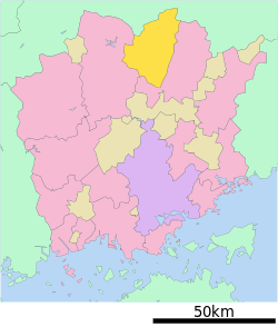 Location of Kagamino in Okayama Prefecture | |||
 Kagamino Location in Japan | |||
| Coordinates: 35°6′N 133°56′E / 35.100°N 133.933°ECoordinates: 35°6′N 133°56′E / 35.100°N 133.933°E | |||
| Country | Japan | ||
| Region |
Chūgoku San'yō | ||
| Prefecture | Okayama Prefecture | ||
| District | Tomata | ||
| Area | |||
| • Total | 419.69 km2 (162.04 sq mi) | ||
| Population (2003) | |||
| • Total | 14,651 | ||
| • Density | 35/km2 (90/sq mi) | ||
| Time zone | UTC+9 (JST) | ||
| Website |
www | ||


Kagamino (鏡野町 Kagamino-chō) is a town located in Tomata District, Okayama Prefecture, Japan.
On March 1, 2005 Kagamino absorbed the town of Okutsu, and the villages of Kamisaibara and Tomi, all from Tomata District, to form the new town of Kagamino, with a combined total area of 419.69 km2 (162 sq mi). The combined population of the towns, using the 2003 estimates, would be 14,651.
As of 2003 (before the merger), the town had an estimated population of 11,188 and a density of 91.52 persons per km². The total area was 122.24 km2 (47 sq mi).
International relations
Twin towns – Sister cities
Kagamino is twinned with:
References
- ↑ "Association Suisse des Communes et Régions d'Europe". L'Association suisse pour le Conseil des Communes et Régions d'Europe (ASCCRE) (in French). Archived from the original on 2012-07-24. Retrieved 2013-07-20.
External links

- Kagamino official website (in Japanese)
This article is issued from
Wikipedia.
The text is licensed under Creative Commons - Attribution - Sharealike.
Additional terms may apply for the media files.