Kumenan
| Kumenan 久米南町 | |||
|---|---|---|---|
| Town | |||
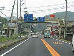 Route in Kumenan | |||
| |||
 Location of Kumenan in Okayama Prefecture | |||
 Kumenan Location in Japan | |||
| Coordinates: 34°56′N 133°58′E / 34.933°N 133.967°ECoordinates: 34°56′N 133°58′E / 34.933°N 133.967°E | |||
| Country | Japan | ||
| Region |
Chūgoku San'yō | ||
| Prefecture | Okayama Prefecture | ||
| District | Kume | ||
| Area | |||
| • Total | 78.65 km2 (30.37 sq mi) | ||
| Population (March 31, 2017) | |||
| • Total | 4,962 | ||
| • Density | 63/km2 (160/sq mi) | ||
| Time zone | UTC+9 (JST) | ||
| Website |
www | ||


Kumenan (久米南町 Kumenan-chō) is a town located in Kume District, Okayama Prefecture, Japan.
As of March 2017, the town has an estimated population of 4,962 and a density of 63 persons per km². The total area is 78.65 km².
External links

- Town of Kumenan (in Japanese)

This article is issued from
Wikipedia.
The text is licensed under Creative Commons - Attribution - Sharealike.
Additional terms may apply for the media files.