Talaud Islands Regency
| Talaud Islands Regency Kabupaten Kepulauan Talaud | ||
|---|---|---|
| Regency | ||
 | ||
| ||
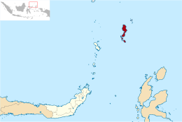 Location within North Sulawesi | ||
| Coordinates: 4°18′42″N 126°46′51″E / 4.31178°N 126.78085°ECoordinates: 4°18′42″N 126°46′51″E / 4.31178°N 126.78085°E | ||
| Country |
| |
| Province |
| |
| Capital | Melonguane | |
| Government | ||
| • Regent | Petrus Tuange | |
| • Vice Regent | vacant | |
| Area | ||
| • Total | 1,240.4 km2 (478.9 sq mi) | |
| Population (2014) | ||
| • Total | 87,562 | |
| • Density | 71/km2 (180/sq mi) | |
| Time zone | UTC+8 (ICST) | |
| Area code | (+62) 433 | |
| Website |
www | |


The Talaud Islands Regency (Indonesian: Kabupaten Kepulauan Talaud, Filipino: Rehensiya ng Kapuluan ng Talaud) is a regency of North Sulawesi province, Indonesia. The Talaud Islands form an archipelago situated to the north-east of Sulawesi, with a land area of 1,240.40 sq.km. They had a population of 83,434 at the 2010 Census;[1] the latest estimate (as at January 2014) was 87,562. The largest island is Karakelong, on which lies the principal town of Melonguane.
Administration
The Regency is divided into nineteen districts (kecamatan), tabulated below with their 2010 Census population.[2]
| Name | Population Census 2010 |
|---|---|
| Kabaruan | 5,472 |
| Damau | 4,127 |
| Lirung | 6,137 |
| Salibabu | 5,566 |
| Kalongan | 3,060 |
| Moronge | 3,505 |
| Melonguane | 10,463 |
| Melonguane Timur (East Melonguane) | 2,964 |
| Beo | 5,521 |
| Beo Utara (North Beo) | 3,609 |
| Beo Selatan (South Beo) | 3,475 |
| Rainis | 5,959 |
| Tampa Na'mma | 5,497 |
| Pulutan | 1,953 |
| Essang | 3,397 |
| Essang Selatan (South Essang) | 3,198 |
| Gemeh | 5,470 |
| Nanusa | 3,333 |
| Miangas | 728 |
References
| Authority control |
|---|
This article is issued from
Wikipedia.
The text is licensed under Creative Commons - Attribution - Sharealike.
Additional terms may apply for the media files.