Talaud Islands
| Native name: Kepulauan Talaud | |
|---|---|
 Talaud Islands location | |
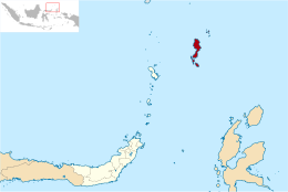 Talaud Islands location in North Sulawesi | |
| Geography | |
| Location | South-east Asia |
| Major islands | Kaburuang, Karakelong, Salebabu |
| Area | 1,281 km2 (495 sq mi) |
| Administration | |
| Province | North Sulawesi |
| Regency | Talaud Islands Regency |
| Demographics | |
| Population | 83,441 (2010) |
| Additional information | |
| Time zone | |
Talaud Islands (Indonesian: Kepulauan Talaud) is a group of islands located north of Sulawesi island in Indonesia, north-east of the Sangihe Islands. The Talaud Islands are also the northernmost region of Eastern Indonesia, bordering south of the Philippines' Davao Region. The group, with a total area of 495 square miles (1,281 square km), includes Karakelong (the largest), Salebabu, Kaburuang, and numerous islets. The coast of Karakelong Island is steep except on the southern shore, which is fringed by a wide reef. The seven tiny Nanusa Islands lie north-east of Karakelong. They are forested and with hills rising to 2,231 feet (680 metres).
Description
The islands were declared a regency of North Sulawesi in 2000 as Kabupaten Kepulauan Talaud.
The largest islands of the Talaud group are Karakelang Island, Salibabu Island, Kabaruan, Karatung, Nanusa and Miangas islands. Population was 83,441 according to the 2010 census.[1]
Grouping Talaud together with Sangihe, there are 77 islands in the Talaud-Sangihe archipelagos, of which 56 are inhabited. The total population of the Talaud and Sangihe islands was 209,574 in 2010.[1]
Most of the population are involved in agriculture, which includes coconuts, vanilla, nutmeg, and cloves. Numerous volcanoes produce very fertile volcanic soil on many of the islands.[2]
Talaud's capital is Melonguane.
Both Sangihe and Talaud have small airstrips serviced by Express Air and Wings Air. Talaud Airport also serves as a transit point for flights to Miangas, one of the Indonesia's outlying island located close to Davao, Philippines.
The region is regularly rocked by large earthquakes and volcanic eruptions, as the Molucca Sea Plate is being consumed in both directions.[3]
As the regency is economically poor, the central government has agreed to construct a road of 91 km long with a budget of 14 billion Rupiah.
See also
References
- 1 2 "Indonesia population statistics". GeoHive.com. Archived from the original on 2016-03-03. Retrieved 2015-06-12.
- ↑ "Sangihe Talaud Islands, North Sulawesi, Indonesia". North-sulawesi.org. Archived from the original on 2015-04-29. Retrieved 2015-06-12.
- ↑ Moore, G.F; Kadarisman, D; Evans, C.A; Hawkins, J.W (1981). "Geology of the Talaud Islands, molucca sea collision zone, northeast Indonesia". Journal of Structural Geology. 3 (4): 467–475. doi:10.1016/0191-8141(81)90046-8.
Coordinates: 4°05′31″N 126°46′05″E / 4.092°N 126.768°E