Tak Fa District
| Tak Fa ตากฟ้า | |
|---|---|
| Amphoe | |
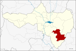 Amphoe location in Nakhon Sawan Province | |
| Coordinates: 15°20′55.8″N 100°29′44.8″E / 15.348833°N 100.495778°ECoordinates: 15°20′55.8″N 100°29′44.8″E / 15.348833°N 100.495778°E | |
| Country | Thailand |
| Province | Nakhon Sawan |
| Seat | Tak Fa |
| Area | |
| • Total | 570.7 km2 (220.3 sq mi) |
| Population (2005) | |
| • Total | 41,192 |
| • Density | 72/km2 (190/sq mi) |
| Time zone | UTC+7 (ICT) |
| Postal code | 60190 |
| Geocode | 6012 |
Tak Fa (Thai: ตากฟ้า, pronounced [tàːk fáː]) is a district (amphoe) in southeastern part of Nakhon Sawan Province.
History
When Thai government built the Phahonyothin Highway, the district was formed by territory taken from Takhli District. It became a district on 13 October 1970.[1][2]
Geography
Neighboring districts are (from the southwest clockwise) Takhli, Phayuha Khiri, Tha Tako, and Phaisali of Nakhon Sawan Province, and Nong Muang of Lopburi Province.
Administration
The district is divided into seven sub-districts (tambon), which are further subdivided into 77 villages (muban). The township (thesaban tambon) of Tak Fa covers parts of the tambon Tak Fa and Suk Samran. There are a further seven tambon administrative organizations (TAO).
| No. | Name | Thai name | Villages | Pop. |
|---|---|---|---|---|
| 1. | Tak Fa | ตากฟ้า | 10 | 7,292 |
| 2. | Lam Phayon | ลำพยนต์ | 12 | 4,724 |
| 3. | Suk Samran | สุขสำราญ | 11 | 7,628 |
| 4. | Nong Phikun | หนองพิกุล | 10 | 3,471 |
| 5. | Phu Nok Yung | พุนกยูง | 16 | 3,850 |
| 6. | Udom Thanya | อุดมธัญญา | 9 | 10,438 |
| 7. | Khao Chai Thong | เขาชายธง | 9 | 3,789 |
References
- ↑ Department of Agricultural Extension
- ↑ พระราชกฤษฎีกาตั้งอำเภอตากฟ้า พ.ศ. ๒๕๑๓ (PDF). Royal Gazette (in Thai). 87 (94 ก): 690–692. October 13, 1970.
External links
This article is issued from
Wikipedia.
The text is licensed under Creative Commons - Attribution - Sharealike.
Additional terms may apply for the media files.