Szögliget
| Szögliget | ||
|---|---|---|
 | ||
| ||
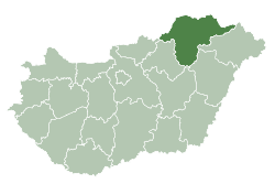
 Szögliget Location of Szögliget in Hungary | ||
| Coordinates: 48°31′22″N 20°40′28″E / 48.52290°N 20.67436°E | ||
| Country | Hungary | |
| Region | Northern Hungary | |
| County | Borsod-Abaúj-Zemplén | |
| Subregion | Edelényi | |
| Rank | Village | |
| Area[1] | ||
| • Total | 34.75 km2 (13.42 sq mi) | |
| Population (1 January 2008)[2] | ||
| • Total | 661 | |
| • Density | 19/km2 (49/sq mi) | |
| Time zone | UTC+1 (CET) | |
| • Summer (DST) | UTC+2 (CEST) | |
| Postal code | 3762 | |
| Area code | +36 48 | |
| KSH code | 16179[3] | |
| Website | www.szogliget.hu | |

Szögliget is a village in Borsod-Abaúj-Zemplén County, Hungary.
References
- ↑ Szögliget at the Hungarian Central Statistical Office (Hungarian).
- ↑ Szögliget at the Hungarian Central Statistical Office (Hungarian). 1 January 2008
- ↑ Szögliget at the Hungarian Central Statistical Office (Hungarian).
| Wikimedia Commons has media related to Szögliget. |

| Authority control |
|---|
This article is issued from
Wikipedia.
The text is licensed under Creative Commons - Attribution - Sharealike.
Additional terms may apply for the media files.