Perkupa
| Perkupa | |
|---|---|
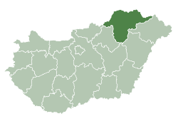
 Perkupa Location of Perkupa | |
| Coordinates: 48°28′16″N 20°41′08″E / 48.47125°N 20.68542°ECoordinates: 48°28′16″N 20°41′08″E / 48.47125°N 20.68542°E | |
| Country |
|
| County | Borsod-Abaúj-Zemplén |
| Area | |
| • Total | 19.4 km2 (7.5 sq mi) |
| Population (2004) | |
| • Total | 925 |
| • Density | 47.68/km2 (123.5/sq mi) |
| Time zone | UTC+1 (CET) |
| • Summer (DST) | UTC+2 (CEST) |
| Postal code | 3756 |
| Area code(s) | 48 |
Perkupa is a village in Borsod-Abaúj-Zemplén county, Hungary.
Names and etymology
The name is of Slavic origin: Prěkopa, Priekopa - a ditch. There are several villages in Slovakia with similar names (e.g. Priekopa, Sobrance District).[1][2][3] 1332—1335 de Precupa. The name of the part Dobódél comes from the name of Dubodiel (Trenčín District).[3]
References
- ↑ Kiss, Lajos (1988). Földrajzi nevek etimológiai szótára (fourth, expanded and revised edition) (in Hungarian). Budapest: Akadémiai Kiadó. p. 337.
- ↑ The first edition of Kiss' monograph (1978) pronouncedly states the name of the village derives from the Slovak language.
- 1 2 Varsik, Branislav (1973). Osídlenie košickej kotliny (in Slovak). Bratislava: Slovenská akadémia vied. pp. 346–347.
External links
- Street map (in Hungarian)

This article is issued from
Wikipedia.
The text is licensed under Creative Commons - Attribution - Sharealike.
Additional terms may apply for the media files.