Tiszapalkonya
| Tiszapalkonya | |
|---|---|
 Tiszapalkonya Location of Tiszapalkonya | |
| Coordinates: 47°53′07″N 21°03′19″E / 47.88516°N 21.05520°ECoordinates: 47°53′07″N 21°03′19″E / 47.88516°N 21.05520°E | |
| Country |
|
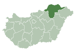
| County | Borsod-Abaúj-Zemplén |
| Area | |
| • Total | 13.49 km2 (5.21 sq mi) |
| Population (2004) | |
| • Total | 1,523 |
| • Density | 112.89/km2 (292.4/sq mi) |
| Time zone | UTC+1 (CET) |
| • Summer (DST) | UTC+2 (CEST) |
| Postal code | 3587 |
| Area code(s) | 49 |
Tiszapalkonya is a village in Borsod-Abaúj-Zemplén county, Hungary.
External links
- Street map (in Hungarian)

This article is issued from
Wikipedia.
The text is licensed under Creative Commons - Attribution - Sharealike.
Additional terms may apply for the media files.