Sugar Creek Township, Parke County, Indiana
| Sugar Creek Township | |
|---|---|
| Township | |
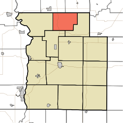 Location in Parke County | |
| Coordinates: 39°55′32″N 87°12′29″W / 39.92556°N 87.20806°WCoordinates: 39°55′32″N 87°12′29″W / 39.92556°N 87.20806°W | |
| Country |
|
| State |
|
| County | Parke |
| Government | |
| • Type | Indiana township |
| Area | |
| • Total | 24.91 sq mi (64.5 km2) |
| • Land | 24.89 sq mi (64.5 km2) |
| • Water | 0.02 sq mi (0.05 km2) 0.08% |
| Elevation[1] | 679 ft (207 m) |
| Population (2010) | |
| • Total | 322 |
| • Density | 12.9/sq mi (5.0/km2) |
| Time zone | UTC-5 (Eastern (EST)) |
| • Summer (DST) | UTC-4 (EDT) |
| ZIP codes | 47832, 47859, 47952 |
| Area code(s) | 765 |
| GNIS feature ID | 453884 |
Sugar Creek Township is one of thirteen townships in Parke County, Indiana, United States. As of the 2010 census, its population was 322 and it contained 154 housing units.[2] The township includes the north half of Turkey Run State Park.
History
Sugar Creek Township was established in 1855.[3]
The Lancelot C. Ewbank House, Richard Lieber Log Cabin, Lusk Home and Mill Site, Narrows Covered Bridge, and Wilkins Mill Covered Bridge are listed on the National Register of Historic Places.[4]
Geography
According to the 2010 census, the township has a total area of 24.91 square miles (64.5 km2), of which 24.89 square miles (64.5 km2) (or 99.92%) is land and 0.02 square miles (0.052 km2) (or 0.08%) is water.[2]
Unincorporated towns
- Grange Corner at 39°56′24″N 87°11′09″W / 39.940042°N 87.185844°W
- Lusks Mills at 39°53′38″N 87°10′53″W / 39.893930°N 87.181400°W
(This list is based on USGS data and may include former settlements.)
Cemeteries
The township contains these two cemeteries: Bristleridge and Cashatt.
Major highways
School districts
- Turkey Run Community School Corporation
Political districts
- State House District 42
- State Senate District 38
References
- "Sugar Creek Township, Parke County, Indiana". Geographic Names Information System. United States Geological Survey. Retrieved 2009-11-01.
- United States Census Bureau 2009 TIGER/Line Shapefiles
- IndianaMap
- ↑ "US Board on Geographic Names". United States Geological Survey. October 25, 2007. Retrieved 2017-05-09.
- 1 2 "Population, Housing Units, Area, and Density: 2010 - County -- County Subdivision and Place -- 2010 Census Summary File 1". United States Census. Retrieved 2013-05-10.
- ↑ History of Parke and Vermillion Counties, Indiana. B.F. Bowen & Cos. 1913. p. 213.
- ↑ National Park Service (2010-07-09). "National Register Information System". National Register of Historic Places. National Park Service.
External links
- Indiana Township Association
- United Township Association of Indiana
- City-Data.com page for Sugar Creek Township
Places adjacent to Sugar Creek Township, Parke County, Indiana | |
|---|---|
Municipalities and communities of Parke County, Indiana, United States | ||
|---|---|---|
| Towns | ||
| Townships | ||
| Unincorporated communities |
| |
| Ghost town | ||
| Footnotes | ‡This populated place also has portions in an adjacent county or counties | |