Stovepipe Wells, California
| Stovepipe Wells | |
|---|---|
| Unincorporated community | |
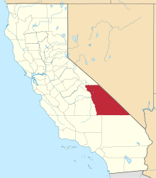
 Stovepipe Wells Location in California  Stovepipe Wells Stovepipe Wells (the US) | |
| Coordinates: 36°36′22″N 117°08′47″W / 36.60611°N 117.14639°WCoordinates: 36°36′22″N 117°08′47″W / 36.60611°N 117.14639°W | |
| Country | United States |
| State | California |
| County | Inyo County |
| Elevation[1] | 10 ft (3 m) |
| Reference no. | 726 |
Stovepipe Wells is a small way-station in the northern part of Death Valley, in unincorporated community Inyo County, California.
Geography and names
Stovepipe Wells is located at 36°36′22″N 117°08′47″W / 36.60611°N 117.14639°W and is US Geological Survey (USGS) feature ID 235564.[1] It is entirely inside Death Valley National Park and along State Route 190 (SR190) at less than 10 feet (3.0 m) above sea level. West on SR190 is Towne Pass at about 4,950 feet (1,510 m) above sea level. Eventually, the road meets Panamint Valley Road at Panamint Junction in the Panamint Valley. East on SR190 the road leads to Furnace Creek and Death Valley Junction.
Variant names listed for the Inyo County location by USGS include Stove Pipe Wells Hotel and Stovepipe Wells Hotel. The US Postal Service ZIP Code is 92328, and the locale name is spelled Stove Pipe Wells in some postal renditions. It is commonly referred to as Stovepipe Wells Village.
Climate
According to the Köppen Climate Classification system, Stovepipe Wells has a hot desert climate, abbreviated "BWh" on climate maps.[2] Its average high temperature is greater than 100 °F from June through September.[2]
| Climate data for Stovepipe Wells, California | |||||||||||||
|---|---|---|---|---|---|---|---|---|---|---|---|---|---|
| Month | Jan | Feb | Mar | Apr | May | Jun | Jul | Aug | Sep | Oct | Nov | Dec | Year |
| Average high °F (°C) | 63.9 (17.7) |
69.1 (20.6) |
78.5 (25.8) |
87.8 (31) |
97.9 (36.6) |
107.9 (42.2) |
114.1 (45.6) |
112.0 (44.4) |
102.8 (39.3) |
88.9 (31.6) |
72.5 (22.5) |
60.9 (16.1) |
88 (31.1) |
| Daily mean °F (°C) | 52.9 (11.6) |
58.6 (14.8) |
67.8 (19.9) |
76.0 (24.4) |
86.0 (30) |
95.1 (35.1) |
101.6 (38.7) |
99.4 (37.4) |
90.6 (32.6) |
77.0 (25) |
61.9 (16.6) |
50.7 (10.4) |
76.5 (24.7) |
| Average low °F (°C) | 41.9 (5.5) |
48.0 (8.9) |
57.0 (13.9) |
64.1 (17.8) |
74.1 (23.4) |
82.3 (27.9) |
89.0 (31.7) |
86.7 (30.4) |
78.4 (25.8) |
65.0 (18.3) |
51.3 (10.7) |
40.5 (4.7) |
64.9 (18.3) |
| Average precipitation inches (mm) | 0.4 (10) |
0.7 (18) |
0.7 (18) |
0.3 (8) |
0.2 (5) |
0.1 (3) |
0.2 (5) |
0.3 (8) |
0.2 (5) |
0.1 (3) |
0.4 (10) |
0.4 (10) |
4 (103) |
| Source: [3] | |||||||||||||
History
The first temporary settlement at Stovepipe Wells came into being when a road between Rhyolite and Skidoo was begun in 1906 to ameliorate the approach to the mine at Skidoo. A collection of tents was erected to serve travelers with food, drink and lodging.
In 1925, entrepreneur Bob Eichmann began construction of the hotel at Stovepipe Wells, along with a scenic toll road through Death Valley. This marked the beginning of the transition from mining community to tourist destination.
The settlement is now registered as California Historical Landmark #826.[4]
Facilities
Stovepipe Wells Village is home to the Stovepipe Wells Hotel, a full-service hotel with swimming pool. The General Store offers sundries and food, and is adjacent to a gas station. Stovepipe Wells Village also houses the Badwater Saloon and Toll Road restaurant, The Nugget Gift Shop and a ranger station.
The default format for wired telephone numbers in the community is in the Death Valley exchange: (760) 786-xxxx. The community had manual telephone service until the late 1980s.
The community is contained within the Great Basin Unified Air Pollution Control District.
Nearby features
- Close to town are some fairly large and accessible stationary sand dunes on the floor of Death Valley. The dunes are roughly 7 miles (11 km) long in the east–west axis. They are located in the space between Salt Creek and Emigrant Wash.
- Stovepipe Well, for which the community is named, is shown to the northeast at 36°39′33″N 117°04′44″W / 36.65917°N 117.07889°W.
- Stovepipe Wells Airport is to the southwest at 36°36′14″N 117°09′33″W / 36.60389°N 117.15917°W. The airport has an identifier of L09 and features a 3,250-foot (990 m) paved runway.
 Stovepipe Wells "downtown"
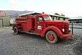 Stovepipe Wells Fire Dept truck
 Burned Wagons plaque
 Stovepipe Wells saloon at dusk
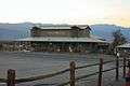 Stovepipe Wells general store at dusk
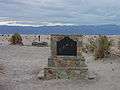
Sources
- 1 2 U.S. Geological Survey Geographic Names Information System: Stovepipe Wells, California
- 1 2 Climate Summary for Stovepipe Wells, California
- ↑ "Monthly Averages for Stovepipe Wells, CA". weatherbase.com. Retrieved 2017-12-24.
- ↑ "Stovepipe Wells". Office of Historic Preservation, California State Parks. Retrieved 2012-10-07.
- 7350.7U Location Identifiers, The National Flight Data Center, Federal Aviation Administration ATPUBS, US Department of Transportation, September 1, 2005.
- Map: Stovepipe Wells, California 7.5-minute quadrangle, US Geological Survey, 1988.
- National Geographic Names Database, US Geological Survey, 1995.
- California Air Resources Board web site.
- Richard E. Lingenfelter. (1988) Death Valley and the Amargosa: A Land of Illusion: University of California Press. p. 290, p. 475.
External links
| Wikimedia Commons has media related to Stovepipe Wells, California. |