Storžič
| Storžič | |
|---|---|
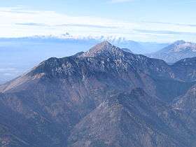 View of Storžič from the Kalce Ridge | |
| Highest point | |
| Elevation | 2,132 m (6,995 ft) |
| Coordinates | 46°21′1.008″N 14°24′16.992″E / 46.35028000°N 14.40472000°ECoordinates: 46°21′1.008″N 14°24′16.992″E / 46.35028000°N 14.40472000°E |
| Geography | |
 Storžič | |
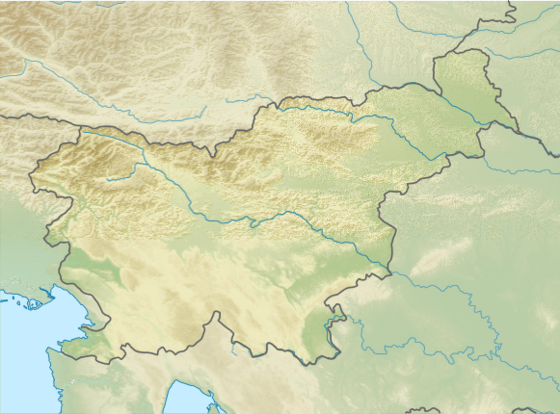
| Parent range | Kamnik–Savinja Alps |
Storžič (pronounced [ˈstɔːɾʒitʃ]; 2132 m) is the highest mountain in the western part of the Kamnik–Savinja Alps. The top is a nicely shaped cone (Slovene: storž), from which the mountain got its name. Storžič has a good panoramic view. To the south are the Ljubljana Basin, Mount Krim, the Javornik Hills, Mount Snežnik, the Nanos Plateau, and the Škofja Loka Hills. To the west are the Julian Alps with prominent Mount Triglav. To the north are the Karawanks with Mount Stol, Mount Begunjščica, and Mount Košuta. To the east are the Jezersko Cirque, Mount Grintovec, the Kalce Ridge and Mount Krvavec.
Starting points
- Bašelj (Preddvor)
- Gozd (Tržič)
- Lom pod Storžičem (Tržič)
- Preddvor
- Spodnje Jezersko (Jezersko)
- Trstenik (Kranj)
Routes
- 4 h: from the Storžič Lodge (Slovene: Dom pod Storžičem, 1,123 m), over Male Poljane via Psico
- 3½ h: from the Storžič Lodge (1,123 m), over Škarjeve peči
- 3 h: from the Storžič Lodge (1,123 m), through Žrelo, over Transverzala
- 1¾ h: from Planinski dom na Kališču hut (1534 m), over Transverzala
- 4½ h: from Zavetišče v Gozdu hut (891 m), passing Mala Poljana
- 4½ h: from Spodnje Jezersko, over Bašeljski vrh
- 3½ h: from Trstenik, passing Velika Poljana or Javornik
- 3 h: from Bašelj, passing Koče nad Malo Pečjo over ridge on an unnmarked route
External links
| Wikimedia Commons has media related to Storžič. |
| Main peaks |  | |
|---|---|---|
This article is issued from
Wikipedia.
The text is licensed under Creative Commons - Attribution - Sharealike.
Additional terms may apply for the media files.