Starvation State Park
| Starvation State Park | |
| Utah State Park | |
 Starvation Reservoir | |
| Country | United States |
|---|---|
| State | Utah |
| County | Duchesne |
| Location | Duchesne |
| - elevation | 5,700 ft (1,737 m) [1] |
| - coordinates | 40°12′10″N 110°26′50″W / 40.20278°N 110.44722°WCoordinates: 40°12′10″N 110°26′50″W / 40.20278°N 110.44722°W |
| Area | 3,500 acres (1,416 ha) [1] |
| Founded | 1972 [1] |
| Management | Utah State Parks |
| Visitation | 70,044 (2011) [2] |
| IUCN category | V - Protected Landscape/Seascape |
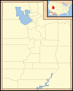 Location of Starvation State Park in Utah | |
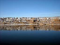
Starvation State Park is a state park in northeastern Utah, United States, featuring the 3,495-acre (1,414 ha) Starvation Reservoir. The park is 4 miles (6.4 km) northwest of the town of Duchesne, Utah.
Facilities
The 3,500-acre (14 km2) Starvation State Park is open year-round, and is popular for fishing and boating. It lies at an elevation of 5,712 feet (1,741 m). Established in 1972, the marina features a 54-unit RV campground along with primitive camping, boat ramp and dock, a sand beach, restrooms, showers, a group-use pavilion, sewage disposal, and fish cleaning stations.[3] Primitive camping is allowed in designated areas around the perimeter of the reservoir for a fee.
History
There are various narratives explaining the name "Starvation". The most credible story was recounted by Orson Mott. In 1900 A.M. Murdock of Heber city, approached Major Myton of the Uintah Indian reservation to purchase grazing permits for his cattle. He was given grazing permits in the upper Strawberry river area. Dave Murdock, brother of Al Murdock had secured a contract to provide beef to the Ute tribe at Fort Duchesne. In the fall of 1904 they brought the herd out of the high grazing areas and made it to the river bottoms which is now covered by Starvation reservoir. Very heavy snows stranded the herd. With no feed the entire herd died. Dave Murdock named the area "Starvation Flats" from this experience. [4]
Another account describes a group of fur trappers stranded in harsh winter conditions who survived by stealing a local Native American cache of food, which resulted in their starvation. Another account tells the opposite story, with the Indians doing the stealing and the trappers starving.[1] A third story involves a local rancher who attempted to graze livestock in the area, and they all starved.[5] Yet another explanation for the name involves settlers in the early 1900s trying to survive along the banks of the Strawberry River, in the area now occupied by the reservoir. These settlers dealt with near-starvation in a hostile environment. Winters in the area are long and cold, and their livestock often died. The area's short growing season was hindered by floods, hail, early frost and other problems. These settlers could have nicknamed the area Starvation.
Starvation Dam
The Starvation Dam (40°11′25″N 110°26′38″W / 40.19028°N 110.44389°W) is a 210-foot-high (64 m), 3,070-foot-long (940 m) earthfill dam. The reservoir is fed by the Strawberry River in the Uinta Basin, and is part of the Central Utah Project – Bonneville Unit. It was constructed in 1970.[6]
References
- 1 2 3 4 "Starvation State Park: About the Park". Utah State Parks. Retrieved 2014-02-23.
- ↑ "Utah State Park 2011 Visitation" (PDF). Utah State Parks Planning. Retrieved 2012-05-28.
- ↑ "Starvation State Park: Amenities". Utah State Parks. Retrieved 2014-02-23.
- ↑ "Highlights from Interview with Orson Mott", Interviewed by JP Tanner 1995
- ↑ Division of Water Quality. "Starvation Reservoir" (PDF). Utah Department of Environmental Quality.
- ↑ Bureau of Reclamation (2009-08-04). "Starvation Dam". U.S. Department of the Interior. Retrieved 2011-02-11.
External links
| Wikimedia Commons has media related to Starvation State Park. |
Municipalities and communities of Duchesne County, Utah, United States | ||
|---|---|---|
| Cities | 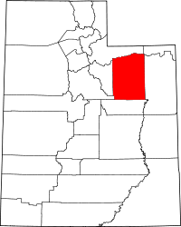 | |
| Towns | ||
| CDPs | ||
| Unincorporated communities | ||
| Indian reservation | ||
| Ghost town | ||
| Footnotes | ‡This populated place also has portions in an adjacent county or counties | |