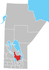
St. Laurent, Manitoba
| St. Laurent | |
|---|---|
 St. Laurent Location of St. Laurent in Manitoba | |
| Coordinates: 50°24′46″N 97°56′27″W / 50.41278°N 97.94083°WCoordinates: 50°24′46″N 97°56′27″W / 50.41278°N 97.94083°W | |
| Country |
|
| Province |
|
| Region | Interlake |
| Census Division | No. 18 |
| Government | |
| • Governing Body | Rural Municipality of St. Laurent Council |
| • MP | James Bezan |
| • MLA | Thomas G. Nevakshonoff |
| Area | |
| • Total | 465.62 km2 (179.78 sq mi) |
| Population | |
| • Total | 1,305[1] |
| • Density | 2.8/km2 (7/sq mi) |
| Time zone | UTC−6 (CST) |
| • Summer (DST) | UTC−5 (CDT) |
| Postal Code | R0C 2S0 |
| Area code(s) | 204 |
| NTS Map | 062I05 |
| GNBC Code | GAXYM |
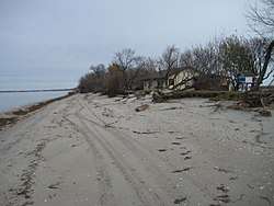
St. Laurent (French St-Laurent) is an unincorporated community in Manitoba, located on the eastern shore of Lake Manitoba and serviced by Manitoba Highway 6. It lies within the boundaries of the Rural Municipality of St. Laurent and is 95 km (59 miles) from Winnipeg.
Originally called Fond du Lac, this Metis community was established in 1824 on the shores of Lake Manitoba. Many Metis moved there after it was found that Pembina was actually in the United States. By 1850, twelve families were established at St. Laurent, including the Lamberts, Chartrands, Lavallees, Pangmans and Ducharmes. More Metis moved there after the Resistance of 1869-70. St. Laurent was originally a fishing, trapping and trading community with small-scale farming. The Metis traded up to the Camperville area on Lake Winnipegosis and would go as far the Summerberry Marsh near The Pas to catch muskrats in the spring. A Roman Catholic mission was established here in 1862. The community was renamed by Father Camper after St. Lawrence, a Christian martyr. [2]
As described in the mid-1980s, the community of around 1.000 people lacked a single townsite, and was instead more like an Old World chain village, as the land was originally divided by the French river lot system (a number of long, narrow farm fields along a central road on the lakeshore), rather than the geometrical patterns of the Dominion Land Survey in much of the rest of Manitoba. The land is primarily glacial till with limited potential for agriculture, though farming does occur in the community. The climate is continental with extreme variation between seasons.
History
Ojibwa language name for this territory is Aggaamaakwaa which means "at the grand opening". It was named as such because this territorial area had a large cleared area, with no trees. Oral historians recorded people still using this name for the community in the 1970s. Another early name for the community was Fond du Lac.[3] The post office opened as Indian Mission in 1872 and changed to St. Laurent in 1873.[4]
European exploration of the region goes back at least to La Vérendrye who explored the area in the 1730s. The first Métis settlement in the area began in 1824 with a group arriving from Pembina. The area was known as a fishing site for the Saulteaux and Métis peoples when the first Roman Catholic priests visited in 1826.[5]
There were twelves families in the community by 1850. The Catholic church established a parish in 1858; Father Laurent Simonet OMI became the first resident priest in 1863, and the first baptisms and funerals are recorded in 1864.[5][6] The first school was built in 1870, and in 1881 the community was incorporated as the Rural Municipality of St. Laurent. By that year the population included 32 Métis families and 50 school-aged children. Franciscan Missionaries of Mary arrived in 1896, and three years later a convent was built. The railway reached the area in 1904, and new settlement followed: between 1905 and 1910 several Breton families arrived from France, followed by some French-Canadian families in the 1930s, and Mennonite families in the 1950s. By the mid-1980s close to three quarters of the population of around 1,000 were Métis.[6]
In 1988, Guy Albert Sylvestre Lavallée, a Roman Catholic priest originally from St. Laurent, completed an ethnographic study of the Métis people of the region for his master's thesis.[6]
The village was threatened by a major flood in the spring and summer of 2011.[7]
Attractions
Attractions in St. Laurent and area include the following events and destinations.[8]
- Manipogo Festival is held at the end of the ice-fishing in March.
- Manipogo Golf & Country Club near Twin Lakes Beach.
- Meindl Beach and Sand Piper Park
- Métis Days
- Métis Music Festival is held yearly on the labour day weekend.
See also
References
- ↑ "Population and dwelling counts, for Canada and census subdivisions (municipalities), 2011 and 2006 censuses". Statistics Canada, 2011 Census. 2014-04-28. Retrieved 2014-07-02.
- ↑ Barkwell, Lawrence J. (2018) Historic Metis settlements in Manitoba and geographical place names. Winnipeg, Manitoba: Louis Riel Institute, 2018. ISBN: 978-1-927531-1-81.
- ↑ "The Métis Homeland: Its Settlements and Communities". Retrieved 2013-02-13.
- ↑ "Post Offices and Postmasters". Retrieved 2013-01-01.
- 1 2 "The Manitoba Historical Society". Retrieved 2013-01-01.
- 1 2 3 "The Métis People of St. Laurent Manitoba: An Introductory Ethnography" (PDF).
- ↑ "St. Laurent residents feel flood's pain". Retrieved 2013-01-01.
- ↑ "Joie de Vivre Manitoba". Retrieved 2013-01-05.
- Geographic Names of Manitoba (pg. 239) - the Millennium Bureau of Canada
Division No. 18, Manitoba (North Interlake Area) | ||||
|---|---|---|---|---|
| Towns |
|  | ||
| Villages |
| |||
| Rural municipalities |
| |||
| First Nations | ||||
| Indian reserves | ||||
| Unorganized areas | ||||
| Unincorporated communities |
| |||