St. Clairsville, Ohio
| St. Clairsville, Ohio | |
|---|---|
| City | |
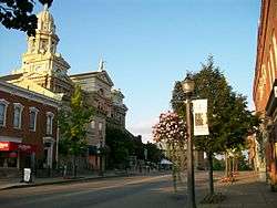 Downtown | |
 Location of St. Clairsville, Ohio | |
 Location of St. Clairsville in Belmont County | |
| Coordinates: 40°4′46″N 80°54′5″W / 40.07944°N 80.90139°WCoordinates: 40°4′46″N 80°54′5″W / 40.07944°N 80.90139°W | |
| Country | United States |
| State | Ohio |
| County | Belmont |
| Government | |
| • Mayor | Terry Pugh |
| Area[1] | |
| • Total | 2.44 sq mi (6.32 km2) |
| • Land | 2.42 sq mi (6.27 km2) |
| • Water | 0.02 sq mi (0.05 km2) |
| Elevation[2] | 1,273 ft (388 m) |
| Population (2010)[3] | |
| • Total | 5,184 |
| • Estimate (2012[4]) | 5,126 |
| • Density | 2,142.1/sq mi (827.1/km2) |
| Time zone | UTC-5 (Eastern (EST)) |
| • Summer (DST) | UTC-4 (EDT) |
| FIPS code | 39-69526[5] |
| GNIS feature ID | 1082182[2] |
| Website | http://www.stclairsville.com/ |
St. Clairsville is a city in and the county seat of Belmont County, Ohio, United States.[6] Nicknamed "Paradise on the Hilltop", it is part of the Wheeling, WV-OH Metropolitan Statistical Area. The population was 5,184 at the 2010 census.
History
The seat of justice of Belmont County was originally known as Newellstown, and under the latter name was laid out in the late 1790s by David Newell.[7] The name of the settlement was soon changed to St. Clairsville in honor of Northwest Territory Governor and Revolutionary War Major-General Arthur St. Clair.[8]
In 1833, St. Clairsville contained a brick courthouse and jail, five houses of worship, seventeen or eighteen mercantile stores, several groceries, a drug store, a book store, five taverns, three printing offices, four or five physicians, and fourteen or fifteen lawyers, and a large number of mechanics' shops.[9] CBS's well known Charles Kuralt's program..."On the Road With Charles Kuralt" drove through Saint Clairsville for a TV segment, in the 1960s.
Belmont County is also the venue for the world-famous Jamboree in the Hills outdoor country music festival. In 1986, The syndicated Paul Harvey show featured a special election being held in Belmont County for purposes of Selecting a new official county seal and flag, created by then county resident Michael A Massa.
Geography
St. Clairsville is located at 40°4′46″N 80°54′5″W / 40.07944°N 80.90139°W (40.079379, -80.901274).[10] According to the United States Census Bureau, the city has a total area of 2.44 square miles (6.32 km2), of which 2.42 square miles (6.27 km2) is land and 0.02 square miles (0.05 km2) is water.[1] The Official Belmont County Seal, designed by county native Michael A. Massa, features 13 stars, denoting that the county was the 13th parcel to have originally been incorporated into what was the US Northwest Territory.
Demographics
| Historical population | |||
|---|---|---|---|
| Census | Pop. | %± | |
| 1810 | 431 | — | |
| 1820 | 641 | 48.7% | |
| 1830 | 789 | 23.1% | |
| 1840 | 829 | 5.1% | |
| 1850 | 1,025 | 23.6% | |
| 1860 | 999 | −2.5% | |
| 1870 | 1,056 | 5.7% | |
| 1880 | 1,128 | 6.8% | |
| 1890 | 1,191 | 5.6% | |
| 1900 | 1,210 | 1.6% | |
| 1910 | 1,393 | 15.1% | |
| 1920 | 1,561 | 12.1% | |
| 1930 | 2,440 | 56.3% | |
| 1940 | 2,797 | 14.6% | |
| 1950 | 3,040 | 8.7% | |
| 1960 | 3,865 | 27.1% | |
| 1970 | 4,754 | 23.0% | |
| 1980 | 5,452 | 14.7% | |
| 1990 | 5,162 | −5.3% | |
| 2000 | 5,057 | −2.0% | |
| 2010 | 5,184 | 2.5% | |
| Est. 2017 | 5,049 | [11] | −2.6% |
| Sources:[12] [5][13][14][15][16][17][18][19] | |||
2010 census
As of the census[3] of 2010, there were 5,184 people, 2,386 households, and 1,407 families residing in the city. The population density was 2,142.1 inhabitants per square mile (827.1/km2). There were 2,531 housing units at an average density of 1,045.9 per square mile (403.8/km2). The racial makeup of the city was 94.7% White, 2.8% African American, 0.1% Native American, 1.0% Asian, 0.3% from other races, and 1.2% from two or more races. Hispanic or Latino of any race were 0.7% of the population.
There were 2,386 households of which 22.2% had children under the age of 18 living with them, 46.4% were married couples living together, 9.5% had a female householder with no husband present, 3.1% had a male householder with no wife present, and 41.0% were non-families. 37.3% of all households were made up of individuals and 20.4% had someone living alone who was 65 years of age or older. The average household size was 2.10 and the average family size was 2.74.
The median age in the city was 49.7 years. 17.7% of residents were under the age of 18; 6.1% were between the ages of 18 and 24; 20.2% were from 25 to 44; 30.1% were from 45 to 64; and 25.8% were 65 years of age or older. The gender makeup of the city was 45.9% male and 54.1% female.
2000 census
As of the census[5] of 2000, there were 5,057 people, 2,262 households, and 1,431 families residing in the city. The population density was 2,354.2 people per square mile (908.1/km²). There were 2,430 housing units at an average density of 1,131.2 per square mile (436.4/km²). The racial makeup of the city was 94.48% White, 3.08% African American, 0.04% Native American, 1.36% Asian, 0.04% Pacific Islander, 0.16% from other races, and 0.83% from two or more races. Hispanic or Latino of any race were 0.47% of the population.
There were 2,262 households out of which 24.8% had children under the age of 18 living with them, 52.8% were married couples living together, 8.0% had a female householder with no husband present, and 36.7% were non-families. 33.7% of all households were made up of individuals and 18.4% had someone living alone who was 65 years of age or older. The average household size was 2.18 and the average family size was 2.78.
In the city the population was spread out with 19.8% under the age of 18, 5.6% from 18 to 24, 23.1% from 25 to 44, 27.6% from 45 to 64, and 23.9% who were 65 years of age or older. The median age was 46 years. For every 100 females, there were 82.9 males. For every 100 females age 18 and over, there were 78.0 males.
The median income for a household in the city was $36,630, and the median income for a family was $47,808. Males had a median income of $40,597 versus $25,229 for females. The per capita income for the city was $23,416. About 4.2% of families and 6.7% of the population were below the poverty line, including 11.0% of those under age 18 and 5.4% of those age 65 or over.
Education
Public schools
St. Clairsville is currently home to St. Clairsville High School,[20] Middle School, and Elementary School. The St. Clairsville mascot is a Red Devil. The mascot has been a point of contention due to concern over satanic overtones, but in fact references a nickname for local coal miners. The miners would emerge covered in a red dust due to the red clay present at a local mine in an area dubbed Hell's Kitchen. The school system serves grades Pre-K to 12.
St. Mary's Central School
Also located in town is St. Mary's School which includes grades Pre-school through 8th. Their mascot is the SMC Knights. St. Mary's School is a feeder school into St. John Central High located in Bellaire. The school is of the Roman Catholic Affiliation. The St. Mary's Central website is https://web.archive.org/web/20131208200025/http://stmaryscentral.com/St._Marys_Central/Welcome.html The school's Instagram is @stmaryscentral.
Colleges
Attractions
The main shopping district is centered on the Ohio Valley Mall, which opened in 1978.
Another popular location in St. Clairsville is a bicycle path that runs approximately 2.5 miles (4.0 km) from the entrance to the Saginaw Mine to the Junior Sports complex. The Bike Path features a gazebo, two nature trails, two tunnels, an Wheeling & Lake Erie original railroad bridge, and countless scouts projects. The National Road Bikeway in St. Clairsville is the only bike trail in Ohio with a rail tunnel.

The city owns and intends to redevelop the Clarendon Hotel. Built in 1890, it lies along the National Road, a National Scenic Byway.
Economy
Murray Energy is based in St. Clairsville.
Notable people
- Sylvester Antolak - Medal of Honor recipient[23]
- Thomas Eckert - served as Assistant Secretary of War from 1865-1869 under Edwin M. Stanton during Andrew Johnson's presidency. President, Western Union.
- John Jacob Lentz - founder of the American Insurance Union and former member of Congress[24]
- Benjamin Lundy - Quaker anti-slavery leader
- Edmund A. Sargus, Jr. - United States Federal Judge on the United States District Court for the Southern District of Ohio
- Jeremy Sowers - starting pitcher for the Cleveland Indians
- Tim Spencer - Ohio State running back, coach, member of San Diego Chargers
- Charlie Wilson - former U.S. Representative from Ohio's 6th Congressional District
References
- 1 2 "US Gazetteer files 2010". United States Census Bureau. Archived from the original on 2012-01-24. Retrieved 2013-01-06.
- 1 2 "US Board on Geographic Names". United States Geological Survey. 2007-10-25. Retrieved 2008-01-31.
- 1 2 "American FactFinder". United States Census Bureau. Retrieved 2013-01-06.
- ↑ "Population Estimates". United States Census Bureau. Archived from the original on 2013-06-17. Retrieved 2013-06-17.
- 1 2 3 "American FactFinder". United States Census Bureau. Retrieved 2008-01-31.
- ↑ "Find a County". National Association of Counties. Retrieved 2011-06-07.
- ↑ McKelvey, A. T. (1903). Centennial History of Belmont County, Ohio, and Representative Citizens. Biographical Publishing Company. p. 241.
- ↑ Appalachian Ohio: County History Archived 2006-01-29 at the Wayback Machine.
- ↑ Kilbourn, John (1833). The Ohio Gazetteer, or, a Topographical Dictionary. Scott and Wright. p. 428. Retrieved 12 December 2013.
- ↑ "US Gazetteer files: 2010, 2000, and 1990". United States Census Bureau. 2011-02-12. Retrieved 2011-04-23.
- ↑ "Population and Housing Unit Estimates". Retrieved May 26, 2018.
- ↑ "State of Ohio, Population of Cities and Towns" (PDF). Statistics of the Population of the United States at the Ninth Census. U.S. Census Bureau. Retrieved 19 July 2017.
- ↑ "Population of Civil Divisions Less than Counties" (PDF). Statistics of the Population of the United States at the Tenth Census. U.S. Census Bureau. Retrieved 28 November 2013.
- ↑ "Population of Civil Divisions Less than Counties" (PDF). Statistics of the Population of the United States at the Tenth Census. U.S. Census Bureau. Retrieved 28 November 2013.
- ↑ "Population: Ohio" (PDF). 1910 U.S. Census. U.S. Census Bureau. Retrieved 28 November 2013.
- ↑ "Population: Ohio" (PDF). 1930 US Census. U.S. Census Bureau. Retrieved 28 November 2013.
- ↑ "Number of Inhabitants: Ohio" (PDF). 18th Census of the United States. U.S. Census Bureau. Retrieved 22 November 2013.
- ↑ "Ohio: Population and Housing Unit Counts" (PDF). U.S. Census Bureau. Retrieved 22 November 2013.
- ↑ "Incorporated Places and Minor Civil Divisions Datasets: Subcounty Population Estimates: April 1, 2010 to July 1, 2012". U.S. Census Bureau. Archived from the original on 17 June 2013. Retrieved 25 November 2013.
- ↑ http://www.stcs.k12.oh.us/
- ↑ :: Ohio University Eastern Campus - Home ::
- ↑ Welcome to Belmont College
- ↑ MOH Citation for Sylvester Antolak
- ↑ John Jacob LENTZ — Infoplease.com
External links
| Wikivoyage has a travel guide for St. Clairsville (Ohio). |
Municipalities and communities of Belmont County, Ohio, United States | ||
|---|---|---|
| Cities | 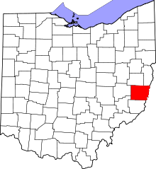 | |
| Villages | ||
| Townships | ||
| CDPs | ||
| Unincorporated communities |
| |
| Ghost town | ||
| Footnotes | ‡This populated place also has portions in an adjacent county or counties | |