Spantekow
| Spantekow | |
|---|---|
 Spantekow Location of Spantekow within Vorpommern-Greifswald district 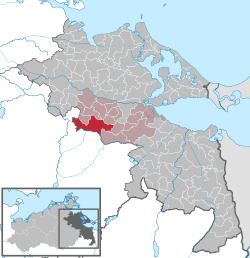 | |
| Coordinates: 53°47′N 13°32′E / 53.783°N 13.533°ECoordinates: 53°47′N 13°32′E / 53.783°N 13.533°E | |
| Country | Germany |
| State | Mecklenburg-Vorpommern |
| District | Vorpommern-Greifswald |
| Municipal assoc. | Anklam-Land |
| Government | |
| • Mayor | Gerold Klien |
| Area | |
| • Total | 70.45 km2 (27.20 sq mi) |
| Elevation | 17 m (56 ft) |
| Population (2017-12-31)[1] | |
| • Total | 1,102 |
| • Density | 16/km2 (41/sq mi) |
| Time zone | CET/CEST (UTC+1/+2) |
| Postal codes | 17392 |
| Dialling codes | 039727 |
| Vehicle registration | VG |
| Website | www.amt-anklam-land.de |
Spantekow is a municipality in the Vorpommern-Greifswald district, in Mecklenburg-Vorpommern, Germany. It comprises the villages Dennin, Drewelow, Fasanenhof, Janow, Japenzin, Neuendorf B, Rehberg, Rebelow and Spantekow.
Since the Middle Ages, Spantekow is a local administrative center and the site of a fortress. Though Spantekow castle was largely destroyed in a Brandenburgian attack in 1677, it remained a residence of the local nobility until 1945. Today, the village is seat of the Amt Anklam-Land.
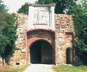
Spantekow castle, gate
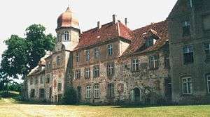
Spantekow castle, palace (still in use)
References
This article is issued from
Wikipedia.
The text is licensed under Creative Commons - Attribution - Sharealike.
Additional terms may apply for the media files.