Kamminke
| Kamminke | |
|---|---|
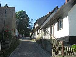 Thatched roofs in Kamminke | |
 Kamminke Location of Kamminke within Vorpommern-Greifswald district 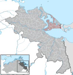 | |
| Coordinates: 53°52′N 14°12′E / 53.867°N 14.200°ECoordinates: 53°52′N 14°12′E / 53.867°N 14.200°E | |
| Country | Germany |
| State | Mecklenburg-Vorpommern |
| District | Vorpommern-Greifswald |
| Municipal assoc. | Usedom-Süd |
| Government | |
| • Mayor | Uwe Hartmann |
| Area | |
| • Total | 2.96 km2 (1.14 sq mi) |
| Elevation | 2 m (7 ft) |
| Population (2017-12-31)[1] | |
| • Total | 248 |
| • Density | 84/km2 (220/sq mi) |
| Time zone | CET/CEST (UTC+1/+2) |
| Postal codes | 17419 |
| Dialling codes | 038376 |
| Vehicle registration | VG |
Kamminke is a municipality in the Vorpommern-Greifswald district, in Mecklenburg-Vorpommern, Germany.
See also
References
External links
![]()
This article is issued from
Wikipedia.
The text is licensed under Creative Commons - Attribution - Sharealike.
Additional terms may apply for the media files.