Southeast Fairbanks Census Area, Alaska
| Southeast Fairbanks Census Area, Alaska | |
|---|---|
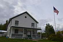 Historic Courthouse in Eagle, Alaska. | |
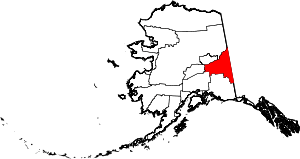 Location in the U.S. state of Alaska | |
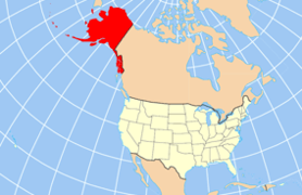 Alaska's location in the U.S. | |
| Established | 1980[1] |
| Largest city | Deltana |
| Area | |
| • Total | 25,059 sq mi (64,903 km2) |
| • Land | 24,769 sq mi (64,151 km2) |
| • Water | 291 sq mi (754 km2), 1.2% |
| Population (est.) | |
| • (2017) | 6,888 |
| • Density | 0.28/sq mi (0.11/km2) |
| Congressional district | At-large |
| Time zone | Alaska: UTC−9/−8 |
Southeast Fairbanks Census Area is a census area located in the U.S. state of Alaska. As of the 2010 census, the population was 7,029.[2] It is part of the unorganized borough and therefore has no borough seat. Its largest communities are Deltana and Tok, both unincorporated CDPs.
Geography
According to the U.S. Census Bureau, the census area has a total area of 25,059 square miles (64,900 km2), of which 24,769 square miles (64,150 km2) is land and 291 square miles (750 km2) (1.2%) is water.[3]
Adjacent boroughs and census areas
- Fairbanks North Star Borough, Alaska – Northwest
- Yukon-Koyukuk Census Area, Alaska – North
- Valdez-Cordova Census Area, Alaska – South
- Matanuska-Susitna Borough, Alaska – Southwest
- Denali Borough, Alaska – West
- Yukon Territory, Canada – East
National protected areas
Demographics
| Historical population | |||
|---|---|---|---|
| Census | Pop. | %± | |
| 1970 | 4,179 | — | |
| 1980 | 5,676 | 35.8% | |
| 1990 | 5,913 | 4.2% | |
| 2000 | 6,174 | 4.4% | |
| 2010 | 7,029 | 13.8% | |
| Est. 2017 | 6,888 | [4] | −2.0% |
| U.S. Decennial Census[5] 1900–1990[6] 1990–2000[7] 2010–2017[2] | |||
As of the census[8] of 2000, there were 6,174 people, 2,098 households, and 1,506 families residing in the census area. The population density was 0.25 people per square mile (0.01/km²). There were 3,225 housing units at an average density of 0.13/sq mi (0.05/km²). The racial makeup of the census area was 78.99% White, 1.98% Black or African American, 12.71% Native American, 0.68% Asian, 0.15% Pacific Islander, 0.73% from other races, and 4.76% from two or more races. 2.70% of the population were Hispanic or Latino of any race. 4.29% reported speaking an Athabaskan language at home, while 4.02% speak Russian, 3.76% Ukrainian, and 2.34% Spanish.[9]
There were 2,098 households out of which 39.40% had children under the age of 18 living with them, 58.20% were married couples living together, 8.60% had a female householder with no husband present, and 28.20% were non-families. 23.50% of all households were made up of individuals and 5.50% had someone living alone who was 65 years of age or older. The average household size was 2.80 and the average family size was 3.34.
In the census area the population was spread out with 32.80% under the age of 18, 7.60% from 18 to 24, 27.80% from 25 to 44, 25.70% from 45 to 64, and 6.10% who were 65 years of age or older. The median age was 34 years. For every 100 females, there were 107.20 males. For every 100 females age 18 and over, there were 108.60 males.
Communities
Cities
Census-designated places
See also
References
- ↑ In 1980, the United States Census Bureau divided the Unorganized Borough into 12 census areas.
- 1 2 "State & County QuickFacts". United States Census Bureau. Archived from the original on May 19, 2014. Retrieved May 18, 2014.
- ↑ "US Gazetteer files: 2010, 2000, and 1990". United States Census Bureau. 2011-02-12. Retrieved 2011-04-23.
- ↑ "Population and Housing Unit Estimates". Retrieved June 9, 2017.
- ↑ "U.S. Decennial Census". United States Census Bureau. Retrieved May 18, 2014.
- ↑ "Population of Counties by Decennial Census: 1900 to 1990". United States Census Bureau. Retrieved May 18, 2014.
- ↑ "Census 2000 PHC-T-4. Ranking Tables for Counties: 1990 and 2000" (PDF). United States Census Bureau. Retrieved May 18, 2014.
- ↑ "American FactFinder". United States Census Bureau. Retrieved 2011-05-14.
- ↑ Language Map Data Center. Mla.org (2013-04-03). Retrieved on 2013-08-02.
External links
- Census Area map, 2000 census: Alaska Department of Labor
- Census Area map, 2010 census: Alaska Department of Labor
![]()
Coordinates: 63°46′N 143°36′W / 63.77°N 143.60°W
Places adjacent to Southeast Fairbanks Census Area, Alaska | ||||||||||
|---|---|---|---|---|---|---|---|---|---|---|
| ||||||||||
Municipalities and communities of Southeast Fairbanks Census Area, Alaska, United States | ||
|---|---|---|
| Cities | | |
| CDPs | ||
| Unincorporated communities | ||
Juneau (capital) | ||
| Topics |  | |
| Society | ||
| Regions | ||
| Largest cities pop. over 25,000 | ||
| Smaller cities pop. over 2,000 | ||
| Boroughs | ||
| Census Areas | ||
| Authority control |
|---|