Kathakne, Alaska
| Kathakne | |
|---|---|
| Unincorporated community | |
 Kathakne Location within the state of Alaska | |
| Coordinates: 62°58′10″N 141°50′0″W / 62.96944°N 141.83333°WCoordinates: 62°58′10″N 141°50′0″W / 62.96944°N 141.83333°W | |
| Country | United States |
| State | Alaska |
| Census area | Southeast Fairbanks |
| Government | |
| • State senator | Click Bishop (R) |
| • State rep. | Dave Talerico (R) |
| Elevation | 1,696 ft (517 m) |
| Time zone | UTC-9 (Alaska (AKST)) |
| • Summer (DST) | UTC-8 (AKDT) |
| GNIS feature ID | 1895065[1] |
Kathakne is an unincorporated community in Southeast Fairbanks Census Area, Alaska, United States. Its name is derived from an Indian language. Its elevation is 1,696 feet (517 m). The community is situated on the northeastern shore of Fish Lake, 3 miles (5 km) east of Northway,[1] near the Northway Airport.[2]
References
- 1 2 "Kathakne, Alaska". Geographic Names Information System. United States Geological Survey.
- ↑ Kathakne, AK, Lat-Long.com, 2008. Accessed 2008-09-16.
Municipalities and communities of Southeast Fairbanks Census Area, Alaska, United States | ||
|---|---|---|
| Cities | 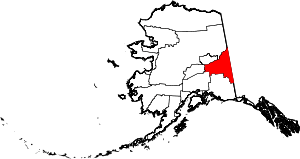 | |
| CDPs | ||
| Unincorporated communities | ||
This article is issued from
Wikipedia.
The text is licensed under Creative Commons - Attribution - Sharealike.
Additional terms may apply for the media files.