Southdowns Airport
| Southdowns Airport | |||||||||||
|---|---|---|---|---|---|---|---|---|---|---|---|
| Summary | |||||||||||
| Airport type | Public | ||||||||||
| Operator | Government | ||||||||||
| Serves | Kalulushi, Kitwe, Chambishi | ||||||||||
| Location | Kitwe, Zambia | ||||||||||
| Elevation AMSL | 4,145 ft / 1,263 m | ||||||||||
| Coordinates | 12°54′01″S 28°08′59″E / 12.90028°S 28.14972°ECoordinates: 12°54′01″S 28°08′59″E / 12.90028°S 28.14972°E | ||||||||||
| Website | Zambia Airports Corp. | ||||||||||
| Map | |||||||||||
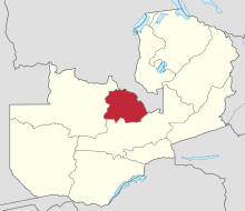 FLSO Location of airport in Zambia (Copperbelt Province in red) | |||||||||||
| Runways | |||||||||||
| |||||||||||
Southdowns Airport (IATA: KIW, ICAO: FLSO) is an airport serving Kitwe, a city in the Copperbelt Province in Zambia. The airport is in the countryside 9 kilometres (5.6 mi) southwest of Kitwe.
The Ndola VOR-DME (Ident: VND) is located 30.8 nautical miles (57.0 km) east of the airport. The Southdowns non-directional beacon (Ident: KT) is located on the field.[4][5]
See also


- Transport in Zambia
- List of airports in Zambia
References
- ↑ "Kitwe-Southdown Airport". SkyVector. Retrieved 25 June 2018.
- ↑ Airport information for Southdowns Airport at Great Circle Mapper.
- ↑ "Southdown Airport". Google Maps. Google. Retrieved 25 June 2018.
- ↑ "Southdowns NDB (KT) @ OurAirports". ourairports.com. Retrieved 2018-08-30.
- ↑ "Ndola VOR-DME (VND) @ OurAirports". ourairports.com. Retrieved 2018-08-30.
External links
- OpenStreetMap - Southdowns Airport
- OurAirports - Southdowns
- Accident history for Kitwe-Southdowns Airport at Aviation Safety Network
This article is issued from
Wikipedia.
The text is licensed under Creative Commons - Attribution - Sharealike.
Additional terms may apply for the media files.