South Leicestershire (UK Parliament constituency)
| South Leicestershire | |
|---|---|
|
County constituency for the House of Commons | |
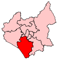 Boundary of South Leicestershire in Leicestershire. | |
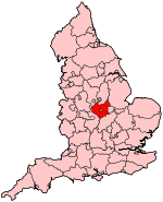 Location of Leicestershire within England. | |
| County | Leicestershire |
| Electorate | 77,412 (December 2010)[1] |
| Major settlements | Lutterworth, Whetstone, Braunstone Town, Narborough and Blaby |
| Current constituency | |
| Created | 2010 |
| Member of parliament | Alberto Costa (Conservative) |
| Number of members | One |
| Created from | Blaby, Harborough |
| 1832–1885 | |
| Number of members | Two |
| Replaced by | Bosworth, Harborough |
| Created from | Leicestershire |
| Overlaps | |
| European Parliament constituency | East Midlands |
South Leicestershire is a constituency[n 1] represented in the House of Commons of the UK Parliament by Alberto Costa, a member of the Conservative Party.[n 2]
The current constituency has similar boundaries to the previous Blaby constituency. Historically the "Southern Division of Leicestershire", was a county constituency, less formally known as South Leicestershire. From 1832 to 1885 it elected two Members of Parliament (MPs) by the bloc vote system of election.
Boundaries
1832-1885: The Hundreds of Gartree (excluding the parishes of Baggrave, Burrough, Knossington, Marefield, Pickwell-cum-Leesthorpe, Ouston, and Newbold-Saucey), Sparkenhoe and Guthlaxton, and the Borough of Leicester and the Liberties thereof.[2]
Boundaries from the 2010 general election
Following its review of parliamentary representation in Leicestershire, the Boundary Commission for England recommended replacing the Blaby constituency with a new South Leicestershire seat, with some boundary changes. This change occurred for the 2010 general election.
The electoral wards used to create the new constituency are;
- Broughton Astley-Astley, Broughton Astley-Broughton, Broughton Astley-Primethorpe, Broughton Astley-Sutton, Dunton, Lutterworth Brookfield, Lutterworth Orchard, Lutterworth Springs, Lutterworth Swift, Misterton, Peatling, and Ullesthorpe in the Harborough District
- Blaby South, Cosby with South Whetstone, Countesthorpe, Croft Hill, Enderby and St John's, Millfield, Narborough and Littlethorpe, Normanton, North Whetstone, Pastures, Ravenhurst and Fosse, Saxondale, Stanton and Flamville, and Winstanley in the Blaby District[3]
Constituency profile
The current South Leicestershire is a slice of Leicestershire to the south west of Leicester, with most of the population in commuter towns and villages clustered close to Leicester itself, both in the suburb of Braunstone Town, including the large modern development of Thorpe Astley, and commuter villages like Whetstone, Blaby and Narborough. Further south it is more rural, with the largest settlement the old market town of Lutterworth. Nearby is the former site of RAF Bitteswell, since redeveloped as Magna Park, one of the largest distribution centres in Europe.[4]
The constituency name of South Leicestershire was new for 2010, but the seat was not massively changed from the old seat of Blaby. Both this as its predecessor are safe Tory seats held by the party since Blaby's creation in 1974. The best known MP to represent the area is the former Chancellor Nigel Lawson.
History
1832-1885
The constituency was created by the Reform Act 1832 for the 1832–33 general election, when the two-seat Leicestershire constituency was replaced by the Northern and Southern divisions, each of which elected two MPs.
Both divisions of the county were abolished by the Redistribution of Seats Act 1885 for the 1885 general election, when they were replaced by four new single-seat constituencies: Bosworth, Harborough, Loughborough and Melton.
Prominent members in this period included Thomas Paget (Jnr) (1807–1892) who followed the footsteps of his father in this role (his father having represented Leicestershire) and as partner in Leicester Bank, and Albert Pell, a member of a group of MPs, which included Henry Chaplin, Sir Massey Lopes and Clare Sewell Read, who supported farming interests. He was also a member of the Council of the Royal Agricultural Society of England.
Members of Parliament
MPs 1832–1885
| Election | 1st Member[5] | 1st Party | 2nd Member[5] | 2nd Party | |||
|---|---|---|---|---|---|---|---|
| 1832 | Edward Dawson | Liberal | Sir Henry Halford, Bt | Tory | |||
| 1834 | Conservative | ||||||
| 1835 | Thomas Frewen Turner | Conservative | |||||
| 1836 by-election | Charles Packe | Conservative | |||||
| 1857 | Viscount Curzon | Conservative | |||||
| 1867 by-election | Thomas Paget | Liberal Party | |||||
| 1868 | Albert Pell | Conservative Party | |||||
| 1870 by-election | William Unwin Heygate | Conservative | |||||
| 1880 | Thomas Paget | Liberal Party | |||||
| 1885 | Redistribution of Seats Act: constituency abolished | ||||||
MPs since 2010
| Election | Member[5] | Party | |
|---|---|---|---|
| 2010 | Andrew Robathan | Conservative | |
| 2015 | Alberto Costa | Conservative | |
Elections
Elections in the 2010s
| Party | Candidate | Votes | % | ± | |
|---|---|---|---|---|---|
| Conservative | Alberto Costa | 34,795 | 61.4 | +8.2 | |
| Labour | Shabbir Aslam | 16,164 | 28.5 | +6.5 | |
| Liberal Democrat | Greg Webb | 2,403 | 4.2 | −3.2 | |
| UKIP | Roger Helmer | 2,235 | 3.9 | −13.4 | |
| Green | Mary Morgan | 1,092 | 1.9 | +1.9 | |
| Majority | 18,631 | 32.9 | +1.7 | ||
| Turnout | 56,801 | 71.8 | +1.5 | ||
| Conservative hold | Swing | +0.83 | |||
| Party | Candidate | Votes | % | ± | |
|---|---|---|---|---|---|
| Conservative | Alberto Costa | 28,700 | 53.2 | +3.7 | |
| Labour | Amanda Hack | 11,876 | 22.0 | +1.1 | |
| UKIP | Barry Mahoney[4] | 9,363 | 17.4 | +13.7 | |
| Liberal Democrat | Geoffrey Welsh | 3,987 | 7.4 | −13.6 | |
| Majority | 16,824 | 31.2 | |||
| Turnout | 53,926 | 70.2 | -1.0 | ||
| Conservative hold | Swing | ||||
| Party | Candidate | Votes | % | ± | |
|---|---|---|---|---|---|
| Conservative | Andrew Robathan* | 27,000 | 49.5 | +4.1 | |
| Liberal Democrat | Aladdin Ayesh | 11,476 | 21.0 | +2.0 | |
| Labour | Sally Gimson | 11,392 | 20.9 | -8.8 | |
| BNP | Peter Preston | 2,721 | 5.0 | +1.5 | |
| UKIP | John Williams | 1,988 | 3.6 | +1.2 | |
| Majority | 15,524 | 28.4 | |||
| Turnout | 54,577 | 71.2 | +6.0 | ||
| Conservative hold | Swing | ||||
- * Served as an MP in the 2005–2010 Parliament
Elections in the 1880s
| Party | Candidate | Votes | % | ± | |
|---|---|---|---|---|---|
| Liberal | Thomas Paget | 3,685 | 35.7 | +6.1 | |
| Conservative | Albert Pell | 3,453 | 33.5 | −3.3 | |
| Conservative | William Unwin Heygate | 3,175 | 30.8 | −2.8 | |
| Majority | 232 | 2.2 | N/A | ||
| Turnout | 6,860 (est) | 76.0 (est) | +1.7 | ||
| Registered electors | 9,022 | ||||
| Liberal gain from Conservative | Swing | +2.9 | |||
| Conservative hold | Swing | −3.2 | |||
Elections in the 1870s
| Party | Candidate | Votes | % | ± | |
|---|---|---|---|---|---|
| Conservative | Albert Pell | 3,583 | 36.8 | +2.9 | |
| Conservative | William Unwin Heygate | 3,269 | 33.6 | −1.3 | |
| Liberal | Thomas Paget | 2,883 | 29.6 | −1.6 | |
| Majority | 386 | 4.0 | +1.3 | ||
| Turnout | 6,309 (est) | 74.3 (est) | +1.9 | ||
| Registered electors | 8,489 | ||||
| Conservative hold | Swing | +1.9 | |||
| Conservative hold | Swing | −0.3 | |||
| Party | Candidate | Votes | % | ± | |
|---|---|---|---|---|---|
| Conservative | William Unwin Heygate | 3,292 | 56.0 | −12.8 | |
| Liberal | Thomas Paget | 2,585 | 44.0 | +12.8 | |
| Majority | 707 | 12.0 | +9.3 | ||
| Turnout | 5,877 | 70.7 | −1.7 | ||
| Registered electors | 8,308 | ||||
| Conservative hold | Swing | −12.8 | |||
- Caused by Curzon-Howe succeeding to the peerage, becoming Earl Howe.
Elections in the 1860s
| Party | Candidate | Votes | % | ± | |
|---|---|---|---|---|---|
| Conservative | George Curzon-Howe | 3,196 | 34.9 | N/A | |
| Conservative | Albert Pell | 3,111 | 33.9 | N/A | |
| Liberal | Thomas Paget | 2,861 | 31.2 | N/A | |
| Majority | 250 | 2.7 | N/A | ||
| Turnout | 6,015 (est) | 72.4 (est) | N/A | ||
| Registered electors | 8,308 | ||||
| Conservative hold | Swing | N/A | |||
| Conservative hold | Swing | N/A | |||
| Party | Candidate | Votes | % | ± | |
|---|---|---|---|---|---|
| Liberal | Thomas Paget | 2,302 | 50.4 | N/A | |
| Conservative | Albert Pell | 2,263 | 49.6 | N/A | |
| Majority | 39 | 0.9 | N/A | ||
| Turnout | 4,565 | 72.7 | N/A | ||
| Registered electors | 6,283 | ||||
| Liberal gain from Conservative | Swing | N/A | |||
- Caused by Packe's death.
| Party | Candidate | Votes | % | ± | |
|---|---|---|---|---|---|
| Conservative | George Curzon-Howe | Unopposed | |||
| Conservative | Charles Packe | Unopposed | |||
| Registered electors | 6,283 | ||||
| Conservative hold | |||||
| Conservative hold | |||||
Elections in the 1850s
| Party | Candidate | Votes | % | ± | |
|---|---|---|---|---|---|
| Conservative | George Curzon-Howe | Unopposed | |||
| Conservative | Charles Packe | Unopposed | |||
| Registered electors | 5,259 | ||||
| Conservative hold | |||||
| Conservative hold | |||||
| Party | Candidate | Votes | % | ± | |
|---|---|---|---|---|---|
| Conservative | George Curzon-Howe | Unopposed | |||
| Conservative | Charles Packe | Unopposed | |||
| Registered electors | 5,205 | ||||
| Conservative hold | |||||
| Conservative hold | |||||
| Party | Candidate | Votes | % | ± | |
|---|---|---|---|---|---|
| Conservative | Henry Halford | Unopposed | |||
| Conservative | Charles Packe | Unopposed | |||
| Registered electors | 5,131 | ||||
| Conservative hold | |||||
| Conservative hold | |||||
See also
Notes and references
- Notes
- ↑ A borough constituency (for the purposes of election expenses and type of returning officer)
- ↑ As with all constituencies, the constituency elects one Member of Parliament (MP) by the first past the post system of election at least every five years.
- References
- ↑ "Electorate Figures - Boundary Commission for England". 2011 Electorate Figures. Boundary Commission for England. 4 March 2011. Archived from the original on 6 November 2010. Retrieved 13 March 2011.
- ↑ "The statutes of the United Kingdom of Great Britain and Ireland. 2 & 3 William IV. Cap. XLV: An Act to amend the Representation of the People in England and Wales". London: His Majesty's statute and law printers. 1832. pp. 154–206. Retrieved 2017-07-27.
- ↑ 2010 post-revision map non-metropolitan areas and unitary authorities of England
- 1 2 http://ukpollingreport.co.uk/2015guide/leicestershiresouth/
- 1 2 3 Leigh Rayment's Historical List of MPs – Constituencies beginning with "L" (part 2)
- ↑ http://www.blaby.gov.uk/about-the-council/voting-elections/general-election-june-2017
- ↑ "General Election 2017: South Leicestershire". The Daily Express. 9 June 2017. Retrieved 14 June 2017.
- ↑ "Election Data 2015". Electoral Calculus. Archived from the original on 17 October 2015. Retrieved 17 October 2015.
- ↑ "Election Data 2010". Electoral Calculus. Archived from the original on 26 July 2013. Retrieved 17 October 2015.
- ↑ Election 2010: South Leicestershire, BBC News
- 1 2 3 4 5 6 7 8 9 Craig, F. W. S., ed. (1977). British Parliamentary Election Results 1832-1885 (e-book)
|format=requires|url=(help) (1st ed.). London: Macmillan Press. pp. 417–418. ISBN 978-1-349-02349-3.