South Fork Flathead River
| South Fork Flathead River | |
|---|---|
 | |
 Map of the Flathead River drainage basin showing the South Fork | |
| Country | United States |
| State | Montana |
| County | Flathead |
| Physical characteristics | |
| Main source | 47°26′44″N 113°11′01″W / 47.44556°N 113.18361°W[1] |
| River mouth |
3,031 feet (924 m) 48°23′22″N 114°05′18″W / 48.38944°N 114.08833°WCoordinates: 48°23′22″N 114°05′18″W / 48.38944°N 114.08833°W[1] |
| Length | 98 miles (158 km) |
| Discharge |
|
| Basin features | |
| River system | Columbia River |
| Basin size | 1,663 sq mi (4,310 km2) |
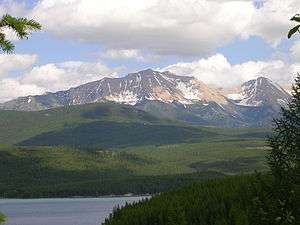
The South Fork Flathead River is a major river in Northwestern Montana in the northwest United States.[2] It is one of the three main forks of the Flathead River, a tributary of the Clark Fork River (the Pend Oreille River). The north-northwest trending river is about 98 miles (158 km) long, making it the second longest tributary of the Flathead River.
The river begins in the Bob Marshall Wilderness south of Glacier National Park, as does the Middle Fork Flathead River, at the confluence of two streams, Danaher Creek and Youngs Creek, between the Flathead Range and the Swan Range. For some 40 miles (64 km), the river flows freely north-northwest, meandering through a forested and undeveloped valley. The river enters a narrow gorge, running north, then begins to enter the backwater of Hungry Horse Reservoir after receiving Meadow Creek from the left. Hungry Horse Reservoir occupies much of the lower half of the river, covering 97 square miles (250 km2). The reservoir trends north then northwest, and the river then passes through the arched Hungry Horse Dam, just a few miles above the mouth. After it leaves the dam, the river enters a narrow gorge and, exiting the canyon for the final time, runs northwest past the town of Hungry Horse, then joins the Flathead River, just a few miles below its headwaters at the North Fork and Middle Forks' convergence.[3]
Notes
- 1 2 "South Fork Flathead River". Geographic Names Information System. United States Geological Survey.
- ↑ "South Fork Flathead River". Geographic Names Information System. United States Geological Survey. 4 April 1980. Retrieved 2009-08-29.
- ↑ Woessner, William; Potts, Donald F.; Running, Steven W.; Kimball, John S.; DeLuca, Thomas H.; Fagre, Daniel B.; Makepeace, Seth; Hendrix, Marc S.; Johnnie, N. Moore; Lorang, Mark S.; Ellis, Bonnie K. (30 July 2004). "Flathead River Basin Hydrologic Observatory, Northern Rocky Mountains" (PDF). Consortium of Universities for the Advancement of Hydrologic Science. www.cuahsi.org. Archived from the original (PDF) on 27 June 2006. Retrieved 2009-08-29.
Municipalities and communities of Flathead County, Montana, United States | ||
|---|---|---|
| Cities | 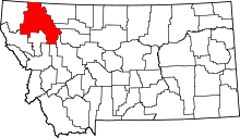 | |
| CDPs | ||
| Unincorporated communities | ||
| Indian reservation | ||
| Footnotes | ‡This populated place also has portions in an adjacent county or counties | |