Sospiro
| Sospiro Suspìir (Lombard) | |
|---|---|
| Comune | |
| Comune di Sospiro | |
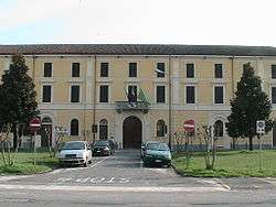 Town hall | |
 Sospiro Location of Sospiro in Italy | |
| Coordinates: 45°6′N 10°9′E / 45.100°N 10.150°ECoordinates: 45°6′N 10°9′E / 45.100°N 10.150°E | |
| Country | Italy |
| Region | Lombardy |
| Province | Cremona (CR) |
| Frazioni | Longardore, S.Salvatore, Tidolo |
| Government | |
| • Mayor | Paolo Abruzzi |
| Area | |
| • Total | 18.96 km2 (7.32 sq mi) |
| Elevation | 36 m (118 ft) |
| Population (28 February 2017)[1] | |
| • Total | 3,094 |
| • Density | 160/km2 (420/sq mi) |
| Demonym(s) | Sospiresi |
| Time zone | UTC+1 (CET) |
| • Summer (DST) | UTC+2 (CEST) |
| Postal code | 26048 |
| Dialing code | 0372 |
| Patron saint | St. Sirus |
| Website | Official website |
Sospiro (Cremunés: Suspìir) is a comune (municipality) in the Province of Cremona in the Italian region Lombardy, located about 90 kilometres (56 mi) southeast of Milan and about 10 kilometres (6 mi) southeast of Cremona.
Sospiro borders the following municipalities: Cella Dati, Malagnino, Pieve d'Olmi, Pieve San Giacomo, San Daniele Po, Vescovato.
References

This article is issued from
Wikipedia.
The text is licensed under Creative Commons - Attribution - Sharealike.
Additional terms may apply for the media files.