Katakwi General Hospital
| Katakwi General Hospital | |
|---|---|
| Uganda Ministry of Health | |
| Geography | |
| Location |
Katakwi, Katakwi District, Eastern Region, Uganda |
| Organisation | |
| Care system | Public |
| Hospital type | General |
| Services | |
| Emergency department | I |
| Beds | 100 |
| History | |
| Founded | 2011 |
| Links | |
| Other links | Hospitals in Uganda |
Katakwi General Hospital, also Katakwi Hospital is a government-owned hospital in the Eastern Region of Uganda.[1]
Location
The hospital is located in the central business district of the town of Katakwi, in Katakwi District, in the Teso sub-region, in Uganda's Eastern Region. This is approximately 52 kilometres (32 mi), northeast of Soroti Regional Referral Hospital.[2] This is about 118 kilometres (73 mi) southwest of Moroto Regional Referral Hospital.[3] The coordinates of hospital are: 01°55'03.0"N, 33°57'44.0"E (Latitude:1.917511; Longitude:33.962214).[4]
Overview
Katakwi General Hospital was established in 2004, as Katakwi Health Centre IV. In 2011, it was elevated to a full fledged hospital, serving patients from Katakwi District and the neighboring districts of Amuria, Kumi, Nakapiripirit and Napak.[1] Like many government hospitals in Uganda, the hospital is understaffed and underfunded.[5]
See also
References
- 1 2 Ninsiima, Racheal (11 May 2016). "-Katakwi Hospital, Like Many Public Health Facilities, Is a Tearjerker". The Observer (Uganda) via AllAfrica.com. Kampala. Retrieved 12 May 2016.
- ↑ GFC (13 May 2016). "Distance between Katakwi Health Center IV, Katakwi, Eastern Region, Uganda and Soroti Regional Referral Hospital, Soroti- Dokolo Road, Soroti, Eastern Region, Uganda". Globefed.com (GFC). Retrieved 13 May 2016.
- ↑ GFC (13 May 2016). "Distance between Katakwi Health Center IV, Katakwi, Eastern Region, Uganda and Moroto Hospital, Moroto, Northern Region, Uganda". Globefeed.com (GFC). Retrieved 13 May 2016.
- ↑ Google (13 May 2016). "Location of Katakwi General Hospital" (Map). Google Maps. Google. Retrieved 13 May 2016.
- ↑ Talemwa, Moses (20 October 2013). "With no doctors or supplies, Uganda hospitals are ailing". The Observer (Uganda). Kampala. Retrieved 13 May 2016.
External links
Capital: Katakwi | ||
| Towns and villages | 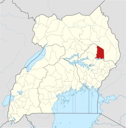 | |
| Economy | ||
| Health | ||
| Transport | ||
| Notable people | ||