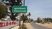
Sooramangalam
| Sooramangalam | |
|---|---|
| Village | |
 Sooramangalam Location in Puducherry, India  Sooramangalam Sooramangalam (India) | |
| Coordinates: 11°53′17″N 79°37′48″E / 11.88816°N 79.630044°ECoordinates: 11°53′17″N 79°37′48″E / 11.88816°N 79.630044°E | |
| Country |
|
| State | Puducherry |
| District | Pondicherry |
| Taluk | Bahour |
| Commune | Nettapakkam |
| Languages | |
| • Official | French, Tamil, English |
| Time zone | UTC+5:30 (IST) |
| PIN | 605 106 |
| Telephone code | 0413 |
| Vehicle registration | PY-01 |
| Sex ratio | 50% ♂/♀ |

Sooramangalam, Nettapakkam Commune
Sooramangalam
Sooramangalam (Tamil: சூரமங்கலம்) is a panchayat village[1] in Nettapakkam Commune in the Union Territory of Puducherry, India.
Geography
Sooramangalam is bordered by Kariyamanickam in the south and rest all three sides by villages belonging to Tamil nadu. Sooramangalam is located on the north tip of Nettapakkam Enclave.
Transport
Sooramangalam is located at 28 km. from Pondicherry. Sooramangalam can be reached directly by any bus running between Pondicherry and Maducarai running via Madagadipattu.
Road Network
Sooramangalam is connected to Pondicherry by Frontier State Highway (RC-21).
Politics
Sooramangalam is a part of Nettapakkam (Union Territory Assembly constituency) which comes under Puducherry (Lok Sabha constituency)
References
External links
This article is issued from
Wikipedia.
The text is licensed under Creative Commons - Attribution - Sharealike.
Additional terms may apply for the media files.