Sonde, Uganda
| Sonde | |
|---|---|
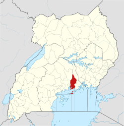
 Sonde Map of Uganda showing the location of Sonde. | |
| Coordinates: 00°23′42″N 32°41′12″E / 0.39500°N 32.68667°E | |
| Country |
|
| District | Mukono District |
| Government | |
| • Village Chairman (LC1)[1] | Abubaker Yawe |
| Elevation | 1,120 m (3,670 ft) |
| Time zone | UTC+3 (EAT) |
Sonde, also Ssonde, is a settlement in Mukono District, in Uganda's Central Region.[1]
Location
Sonde lies in Misindye Parish, Goma Sub-county, Mukono District, approximately 17 kilometres (11 mi), northeast of Kampala, Uganda's capital city.[1][2]
Sonde is bordered by Nabusugwe to the north, Bukeerere to the east, Namanve to the south and Namugongo to the west. Its geographical coordinates are:0°23'42.0"N, 32°41'12.0"E (Latitude:0.395000; Longitude:32.686667).[3]
Overview
Previously regarded as "remote", the village began to receive new settlers, following the end of the Ugandan Bush War (1981 - 1986).[1]
In the 2000s, the area has become popular with developers of residential housing estates. The developers buy large chunks of land, subdivide them and build individual houses for sale.[1] The popularity of Sonde increased in popularity when National Water and Sewerage Corporation (NWSC) extended its services to the area, circa 2012.[1]
In 2016, the road between Namugongo to the west and Seeta to the east as tarmacked, easing transportation and reducing the dusty environment.[1]
Points of interest
The following points of interest are found in Sonde or near its boundaries:
- Namugongo- Seeta Road passes through the town in a general west to east direction
- Development Microfinance, a local financial services provider, offers savings opportunities and reasonably priced loans
- St. Michael High School is one of the five secondary schools, in addition to about 10 elementary and nursery schools
- Nakiyanja River, with the surrounding Nakiyanja wetland lie immediately west of Sonde and separate it from Namugongo
- Martyrs View Estate Sonde, a two minute drive west of Sonde town, estate overlooking Protestant Shrine Namugongo.[4]
See also
References
- 1 2 3 4 5 6 7 Roland D Nasasira (20 July 2017). "Sonde: From killing ground to growing residential area". Daily Monitor. Kampala. Retrieved 20 July 2017.
- ↑ GFC (20 July 2017). "Distance between Post Office Building, Kampala Road, Kampala, Uganda and Sonde Community Market, Ssonde Road, Kampala, Uganda". Globefeed.com (GFC). Retrieved 20 July 2017.
- ↑ Google (20 July 2017). "Location of Sonde, Mukono District, Uganda" (Map). Google Maps. Google. Retrieved 20 July 2017.
- ↑ http://www.monitor.co.ug/Magazines/HomesandProperty/Sonde-killing-ground-growing-residential-area/689858-4021688-t3sg6p/index.html
External links
Capital: Mukono | ||
| Counties and sub-counties |
|  |
| Towns and villages | ||
| Economy |
| |
| Banking | ||
| Notable landmarks | ||
| Transport | ||
| Education | ||
| Energy | ||
| Health | ||
| Notable people | ||