Sleaford Bay
| Sleaford Bay Kuya Bidni Tannanna | |
|---|---|
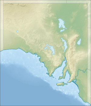 Sleaford Bay Location in South Australia | |
| Location | Eyre Peninsula, South Australia |
| Coordinates | 34°53′54″S 135°46′02″E / 34.898337°S 135.76709°ECoordinates: 34°53′54″S 135°46′02″E / 34.898337°S 135.76709°E[1] |
| Type | Bay |
| Etymology | Sleaford, Lincolnshire[2] |
| Basin countries | Australia |
| Designation | Marine park[1] |
| Max. length | about 16 kilometres (9.9 mi)[3] |
| Max. width | about 9 kilometres (5.6 mi)[3] |
| Max. depth | about 53 metres (174 ft)[3] |
| Islands | one[4] |
| Settlements |
Sleaford [1] Lincoln National Park [1] |
Sleaford Bay is a bay located in the Australian state of South Australia on the southern coast of Eyre Peninsula. It was named by the British navigator, Matthew Flinders in 1802.
Extent & description
Sleaford Bay is located on the south coast of Eyre Peninsula in South Australia about 21 kilometres (13 mi) south-west of the municipal seat of Port Lincoln.[1]
It lies between the headland of Cape Wiles at its western extremity and headland of Cape Tournefort at its eastern extremity. A subsidiary bay named Fishery Bay is located on its west side about 2 nautical miles (3.7 km; 2.3 mi) north of Cape Wiles.[4]
History
The bay was named after the town of Sleaford in Lincolnshire, England by the British navigator, Matthew Flinders in 1802.[2]
The bay also known respectively by local aboriginal people as Kuya Bidni by the “Sleaford Mere tribe (presumably Nauo)” and as Tannanna by "the Eyre Peninsula tribe (presumably Pankala)."[1] The Baudin expedition who visited after Flinders gave it two names – Baudin used the name Anse des Nerlans while Peron and Freycinet revised it to Baie Lavoisier after Baudin’s death.[1]
A whaling station located on the coastline within Fishery Bay was in operation from 1839 to 1841.[5]
Settlements and port infrastructure
The coastline of Sleaford Bay is occupied by the locality of Sleaford in the west and by the locality of Lincoln National Park in the east.[1]
As of 2005, port infrastructure within the bay consisted of a boat ramp located in Fishery Bay.[6]
Protected area status
The Thorny Passage Marine Park occupies the full extent of the bay while the Lincoln National Park extents to Mean Low Water Mark on its eastern side.[7][8]
References
- 1 2 3 4 5 6 7 8 "Search result for "Sleaford Bay, BAY" with the following datasets selected – "NPW and Conservation Reserve Boundaries", "State Marine Park Network", "Suburbs and Localities" and "Gazetteer'". Location SA Map Viewer. Government of South Australia. Retrieved 9 September 2018.
- 1 2 Manning, Geoffrey. "Place Names of South Australia - Hardwicke Bay". State Library of South Australia. Retrieved 23 March 2016.
- 1 2 3 South Australia. Department of Marine and Harbors (DMH) (1985), The Waters of South Australia a series of charts, sailing notes and coastal photographs, Dept. of Marine and Harbors, South Australia, p. chart 34, ISBN 978-0-7243-7603-2
- 1 2 Pub175, Sailing directions (enroute) north, west, and south coast of Australia (PDF) (13th ed.). National Geospatial-Intelligence Agency. 2017. p. 181. Retrieved 9 September 2018.
- ↑ Staniforth, Mark (1999), "South Australian Projects, Sleaford Bay", Archaeology of Whaling in Southern Australia and New Zealand Project, Flinders University
- ↑ Boating Industry Association of South Australia (BIA); South Australia. Department for Environment and Heritage (2005), South Australia's waters an atlas & guide, Boating Industry Association of South Australia, p. 215, ISBN 978-1-86254-680-6
- ↑ "Thorny Passage Marine Park Management Plan 2012" (PDF). Department of Environment Water and Natural Resources. 2012. pp. 24/31. Retrieved 3 April 2014.
- ↑ "Lincoln National Park Management Plan". Department of Environment and Heritage (DEH). 2004. p. 4.