Siswan
| Siswan सिसवाँ | |
|---|---|
| CD Block | |
 Siswan Location in Bihar, India | |
| Coordinates: 25°56′27″N 84°23′51″E / 25.9407°N 84.39757°ECoordinates: 25°56′27″N 84°23′51″E / 25.9407°N 84.39757°E | |
| Country |
|
| State | Bihar |
| District | Siwan |
| Subdivision | Siwan |
| Headquarters | Siswan (town) |
| Government | |
| • Type | Community development |
| • Body | Siswan Block |
| Area | |
| • Total | 115.78 km2 (44.70 sq mi) |
| Population (2011) | |
| • Total | 153,953 |
| • Density | 1,300/km2 (3,400/sq mi) |
| Languages | |
| • Official | Bhojpuri, Hindi, Urdu, English |
| Time zone | UTC+5:30 (IST) |
Siswan (Hindi: सिसवाँ) is a Community development block and a town in district of Siwan, in Bihar state of India. It is one out of 13 blocks of Siwan Subdivision. The headquarter of the block is at Siswan town. [1]
Total area of the block is 115.78 square kilometres (44.70 sq mi) and the total population of the block as of 2011 census of India is 153,953. [2]
The block is divided into many Gram Panchayats and villages.
Gram Panchayats
Gram panchayats of Siswan block in Siwan Subdivision, Siwan district[3].
- Baghauna
- Bakhari
- Bhagar
- Bhikhpur
- Chainpur Mubarakpur
- Gangpur Siswan
- Ghurghat
- Gyaspur
- Kachnar
- Nayagaon
- Ramgarh
- Rampur
- Siswa kala
See also
References
- ↑ "Siswan Community Development Block". www.indikosh.com. Retrieved 27 Sep 2018.
- ↑ "DISTRICT CENSUS HANDBOOK - Census of India" (PDF). www.censusindia.gov.in. Retrieved 3 July 2018.
- ↑ "Village & Panchayats". www.siwan.nic.in. Retrieved 3 July 2018.
Headquarter: Siwan | ||
| Siwan Subdivision | 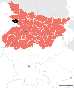 | |
| Maharajganj Subdivision | ||
| Municipalities | ||
This article is issued from
Wikipedia.
The text is licensed under Creative Commons - Attribution - Sharealike.
Additional terms may apply for the media files.