Sirajganj District
| Sirajganj সিরাজগঞ্জ | |
|---|---|
| District | |
| Nickname(s): Gateway to the North Bengal | |
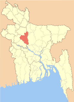 Location of Sirajganj in Bangladesh | |
| Coordinates: 24°20′N 89°37′E / 24.33°N 89.62°ECoordinates: 24°20′N 89°37′E / 24.33°N 89.62°E | |
| Country |
|
| Division | Rajshahi Division |
| Government | |
| • Jatiyô Shôngshôd constituencies | Sirajganj-1, Sirajganj-2, Sirajganj-3, Sirajganj-4, Sirajganj-5, Sirajganj-6 (Bangladesh Awami League) |
| Area | |
| • Total | 2,497.95 km2 (964.46 sq mi) |
| Flood plain and Marsh land | |
| Elevation | 7 m (23 ft) |
| Population (2011 census) | |
| • Total | 3,097,489 |
| • Density | 1,200/km2 (3,200/sq mi) |
| Demonym(s) | Sirajganji, Shirazgonji, Rajshahiyo |
| Literacy rate | |
| • Total | 68% |
| Time zone | UTC+6 (BST) |
| Postal code | 6700-6760 |
| Website |
www |
Sirajganj (Bengali: সিরাজগঞ্জ জেলা, Sirajganj Jela also Sirajganj Zila) is a district in north-central Bangladesh. It is a part of the Rajshahi Division.[1]
History
In 1762, a severe earthquake changed the flow of the Jamuna river and created a new river named Baral. On the west bank of this Baral river, new land emerged and most of the land of surrounding it belonged to Zamindar Siraj Ali Chowdhury. So, after his name gradually this area got its recognition as Sirajganj. Currently it is famous for its hand-loom cottage industries and more than 50% people here are related with this business.
Timeline
- 1885: Emerged as subdivision
- 1922: Historic Salanga Movement (1200 killed)
- 1924: Conference of All India Congress Party
- 1928: Convention of Bhramma Samaj
- 1932: Visit of Kazi Nazrul Islam
- 1940: A. K. Fazlul Huq laid the foundation stone of Sirajgonj Government College
- 1942: All India Muslim League Conference attended Muhammad Ali Jinnah
- 1971, December 16: liberated in liberation war
- 1984: Upgraded to District
Location
Sirajganj District is the gateway to the North Bengal. It is bordered on the north by Bogra District and Natore District ; on the west by Natore District and Pabna District ; on the south by Pabna District and Manikganj District ; on the east Manikganj District, Tangail District and Jamalpur District .
Geography
Sirajganj District of Rajshahi division has an area of about 2497.92 km². The main rivers are Jamuna, Baral, Ichamati, Karatoya and Phuljuri. The annual average temperature reaches a maximum of 34.6 °C, and a minimum of 11.9 °C. The annual rainfall is 1610 mm (63.4 in).
Administration
Sirajganj Sub-division was established in 1885 under Pabna district and it was turned into a district in 1984. Of the nine upazilas of the district Ullahpara is the largest (414.43 km2) and Kamarkhanda is the smallest (91.61 km2). Moreover, the district has six municipals, six Parliament seats, 82 unions and 2016 villages.
List of Upazilas
There are nine (9) Upazilas, namely :
- Sirajganj Sadar Upazila
- Kazipur Upazila
- Ullahpara Upazila
- Shahjadpur Upazila
- Raiganj Upazila
- Kamarkanda Upazila
- Tarash Upazila
- Belkuchi Upazila
- Chauhali Upazila
- Salanga
- Brlkuchi
History of the War of Liberation In 1971
Sector in liberation
During the Liberation war of Bangladesh, Sirajganj was under sector number seven.
Fighting and attaining freedom
Palashdanga Juba Shibir (youth camp) was formed at Kalibari of Bhadraghat union under Kamarkhanda upazila. During the WAR OF LIBERATION this Juba Shibir played remarkable role in encounters against the Pak army at different places of Bangladesh. On 20 April, an encounter was held between the freedom fighters and the Pak army at a place near the Ghatina bridge in Ullahpara upazila in which 15 Pak soldiers were killed; in this encounter 50 freedom fighters and civilians were also wounded. On 23 April, the Pak army conducted mass killing, plundering, violation of women and burning at Ullahpara. On 25 April, the Pak army shot many people dead at Chariashika and Charia Kalibari near Hatikamrul Square of this upazila. A battle was fought between the freedom fighters and the Pak army on 11 November at Naogaon of Tarash upazila in which 130 Pak soldiers and razakars were killed. The freedom fighters attacked the Sambhudia Pak military camp of Chauhali upazila on 19 November and captured two firearms. On 27 November, the freedom fighters again attacked the Sambhudia camp causing considerable damages to the camp; in this attack 5 freedom fighters were wounded. Chauhali upazila was liberated on 29 November. In December 1971, a battle was fought between the Pak army and the freedom fighters at village Baraitala of Gandail union under Kazipur upazila in which several freedom fighters lost their lives. The Pak army in collaboration with the local razakars conducted heavy plundering and set many houses of Malipara on fire on 22 June and at Sambhudia in mid August. The freedom fighters attacked the Sambhudia Pak military camp on 19 November and captured two firearms. On 27 November the freedom fighters again attacked the Sambhudia camp causing considerable damages to the camp; in this attack 5 freedom fighters were wounded. Chauhali upazila was liberated on 29 November. On 7 December 1971, a battle was fought between the freedom fighters and the Pak army on WAPDA dam of Rajapur union in which the Pak army was defeated and one freedom fighter was killed. Besides, another battle was fought between the freedom fighters and the Pak army at the north side of the graveyard of Tamai Paschimpara of Bhangabari union in which three Pak soldiers and two freedom fighters were killed. Encounters between the freedom fighters and the Pak army were held at different places of the upazila including at Sailabari, Degree College and on the bank of the river Jamuna. On 14 December, Ullahpara was liberated and with this the capitulation of the whole of Sirajganj district was completed.
Marks of the War of Liberation
Mass graves 2 (Baroitala of Kazipur upazila, Asbaria of Tarash upazila);
Martyr memorial monument 2 (“Durjay Bangla” at Chandidasgati of Sirajganj sadar upazila and Ghatina of Ullahpara upazila).
Population
The population has been measured at 3,215,873, made up of 80% Muslim, 18.5% Hindu and 1.5% other. Males make up 51.14% of the population and females 48.86%.
Education
There are many schools and colleges in the district of Sirajganj - see this institution list. Harinathpur A.M.Multilateral High School (estd 1969)B.L.Govt. High School(estd.1869), Shaleha Ishaque Girls School, Chowbari Islamia High School(estd.1913), Salop High School (estd.1905),Provakar vidyaniketan-tamai, Adachaki High school" Tamai M.L High School, Dhanghara High School, Harina Bagbati High School, Boyra Bhennabari High School and Ghorachara High School. Among them.The students of these institutions are very enthusiastic, studious, brilliant and extremely great in their behavior.The most famous colleges in Sirajganj are 'Sirajganj Govt. University College', Govt. Akbar Ali College(estd.1970)[3] , Ullapara Science College and Salanga Degree College. Fuljore Degree College, situated by the side of the approach road of the Jamuna Bridge, Salop College in Ullapara and Kuripara College in Sadar Upozilla in recent years are playing an important role to educate the rural peoples of Sirajganj. There is an English-medium(Edexcel certified) school, Jewel's Oxford Int'l School and College, in this district. There is also an English- version school in here named Sirajganj Collectorate School and College, which is administered by the District Commissioner. Students of Sirajganj are very enthusiastic about study, they take part in various extra- curricular activities like the Math and Science Olympiads, Spelling Bee, art competitions etc. It is the birthplace of many geniuses and great minds like Yadav Chakravarty and Maulana Abdul Hamid Khan Vasani.
Historical Places of Sirajganj
Chalan Beel Chalan Beel is a wetland in Bangladesh. It is a large inland depression, marshy in character, with rich flora and fauna. Forty-seven rivers and other waterways flow into the Chalan Beel.[1] As silt builds up in the beel, its size is being reduced.[
Bangabandhu Bridge
Also known as the Jamuna Bridge,It is 4.8 kilometres long and it has 50 pillars and 49 spans,Rail crossing connects Bangladesh and the region to the cross-continental Trans-Asian Railway, which has led to a radical shift in the economics of the area. Costing nearly 700 million US dollars, the bridge was the largest infrastructure project Bangladesh had ever attempted in its history. To many, it represents the nation's rapid development and move to become a moderate economic power.
One does not have to pay to look at the bridge, but there is a fee to cross it! This can change, but usually amounts to 400 taka (just under US$5) for a car to cross. Another experience can be to hire a local boat or fisherman to take you underneath the bridge, to see it in all its concrete glory.
Rabindra Kachharibari Kachharibari's house
The famed poet and philosopher, Rabindranath Tagore, created many of his literary works while living in this mansion. His grandfather purchased the estate in 1840, and Tagore would often visit in the late-1800s to escape the busier side of his life.
The building has since been converted into a museum and a memorial in his name. Many artefacts and memorabilia items are on display in the museum, including shoes, wooden sandals, a piano and a harmonium. The building itself is of interesting architectural heritage, and contains 7 rooms. Maintenance by the authorities has been patchy. Some areas have been well-restored, while others are in desperate need of repair. It has been reported that significant repairs are taking place as of 2012, Tagore's 150th birth anniversary.
Each year, locals and officials celebrate Tagore's birthday at the mansion. This falls on three days around 25 Boishakh in the Bengali calendar, generally correlating with the 6th to 8th of May.
The museum is located in the town of Shahzadpur, open Monday to Saturday, 9am to 6pm. Entry is 5 taka.
Nabaratna
Nabaratna is a place as well as palace situated beside sirajgonj road, hatikumrul, sirajgonj. Nabaratna has historical value in the history of land lords in Bangladesh.
Notable people
- Maulana Abdul Hamid Khan Bhasani, 1st chairman of Bangladesh Awami League[4]
- Captain M. Monsur Ali, Minister of finance of Bangladesh government in exile and 3 rd Prime Minister of Bangladesh[5]
- Maulana Abdur Rashid Tarkabagish[6]
- Syed Ismail Hossain Siraji, Poet[7]
- Abdullah-Al-Muti, Prolific science fiction writer[8]
- Suchitra Sen, film actress[9]
- Abdul Latif Mirza, Founder of Mirza Bahini during Bangladesh Liberation War)[10][11]
- Zahid Hasan, actor
- Khwaja Yunus Ali, Sufi saint
Bridges in Sirajgnaj
Like many other districts in Bangladesh. Sirajgnaj is also a district with many rivers. To cross the rivers and bring revolution by exporting local products to the other districts and countries a lot of bridges have been constructed over the rivers. The main bridges are Bangabandhu Multipurpose Bridge over the River Jamuna, Nalka Bridge Over the River Foljodre, Eliot Bridge etc.
References
- ↑ Kamrul Islam (2012), "Sirajganj District", in Sirajul Islam and Ahmed A. Jamal, Banglapedia: National Encyclopedia of Bangladesh (Second ed.), Asiatic Society of Bangladesh
- ↑ Sheren, Syeda Momtaz, "War of Liberation, The", Banglapedia, retrieved 25 July 2015
- ↑ www.gaac.edu.bd
- ↑ Haq, Enamul, "Bhasani, Maulana Abdul Hamid Khan", Banglapedia, retrieved 25 July 2015
- ↑ Baig, Md. Azom, "Ali, Captain M Mansur", Banglapedia, retrieved 25 July 2015
- ↑ Kader, Rozina, "Tarkabagish, Maulana Abdur Rashid", Banglapedia, retrieved 25 July 2015
- ↑ http://chhatrasangbadbd.com/কবি-ইসমাইল-হোসেন-সিরাজী-ত/
- ↑ Miah, Sajahan, "Sharafuddin, Abdullah Al-Muti", Banglapedia, retrieved 25 July 2015
- ↑ চিরঅন্তরালে সুচিত্রা সেন. bdnews24.com (in Bengali).
- ↑ Amirul Islam. সিরাজগঞ্জে মুক্তিযুদ্ধের সংগঠক,সাবেক প্যানেল স্পীকার বীর মুক্তিযোদ্ধা আব্দুল লতিফ মির্জা’র ৫ম মৃত্যুবার্ষিকী পালিত. bijoynews24.com (in Bengali).
- ↑ রাজনীতির বহু প্রত্যক্ষ সাক্ষী বাংলার শ্রেষ্ঠ সন্তান আব্দুল লতিফ মির্জার ম্যুরাল স্তম্ভে শ্রদ্ধা নিবেদন. sirajgonjnews24 (in Bengali).
- Bangladesh Population Census 2011.
- Bangladesh Bureau of Statistics.
- Cultural survey report of Sirajganj District 2007:
- Cultural survey report of Upazilas of Sirajganj District 2007.
External links
| Wikimedia Commons has media related to Sirajganj District. |