Sila Region
| Sila Dar Sila | |
|---|---|
| Region | |
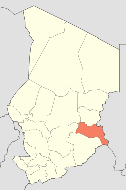 Map of Chad showing Sila. | |
| Coordinates: 12°13′25″N 21°24′52″E / 12.22361°N 21.41444°ECoordinates: 12°13′25″N 21°24′52″E / 12.22361°N 21.41444°E | |
| Country | Chad |
| Departments | 2 |
| Sub-prefectures | 10 |
| Region | 2008 |
| Regional capital | Goz Beïda |
| Population (2009)[1] | |
| • Total | 387,461 |
Sila or Dar Sila[2] is a region of Chad which was created in 2008 from the departments of Sila and Djourf Al Ahmar previously part of Ouaddaï Region.
Subdivisions
Sila is divided into two departments:
| Department | Capital (chef-lieu) | Sub-prefectures |
|---|---|---|
| Djourf Al Ahmar | Am Dam | Am Dam, Magrane, Haouich |
| Kimiti | Goz Beïda | Goz Beïda, Koukou-Angarana, Tissi, Adé, Mogororo, Kerfi, Moudeïna |
See also
References
- ↑ DEUXIEME RECENSEMENT GENERAL DE LA POPULATION ET DE L’HABITAT: RESULTATS GLOBAUX DEFINITIFS (PDF) (Report). INSEED. March 2012. p. 24. Retrieved 10 March 2017.
- ↑ "Map of Chad, showing region names and borders" (PDF). United Nations Cartographic Section. Retrieved 30 August 2012.
| ||
This article is issued from
Wikipedia.
The text is licensed under Creative Commons - Attribution - Sharealike.
Additional terms may apply for the media files.