Shymkent
| Shymkent | |
|---|---|
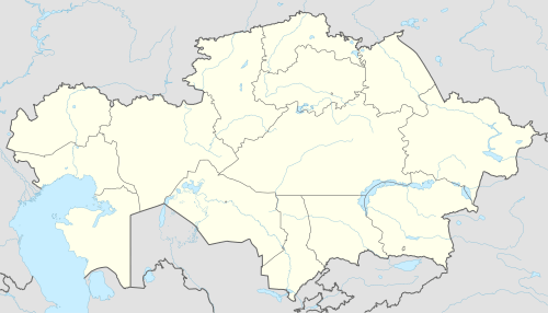 Shymkent Location in Kazakhstan | |
| Coordinates: 42°19′0″N 69°35′45″E / 42.31667°N 69.59583°E | |
| Country | Kazakhstan |
| Founded | 12th century |
| Government | |
| • Akim (mayor) | Gabidulla Abdrahimov |
| Area | |
| • Total | 1,170 km2 (450 sq mi) |
| Elevation | 506 m (1,660 ft) |
| Population (2018 est.)[1] | |
| • Total | 1,002,291 |
| • Density | 860/km2 (2,200/sq mi) |
| Time zone | UTC+6 (BTT) |
| Postal code | 160000 |
| Area code(s) | (+7) 7252 |
| Vehicle registration | 17 |
| Website |
shymkent |
Shymkent (Kazakh: Шымкент, translit. Shymkent, شىمكەنت, known until 1993 as Chimkent;[2] Uzbek: Чимкент, چىمكېنت; Russian: Чимкент, translit. Čimkent), is a city in the Republic of Kazakhstan; one of the three cities which have the status equal to that of a region (the city of republican significance[3]). It is the third most populous city in Kazakhstan behind Almaty and Astana with an estimated population of 1,002,291 as of 1st June 2018.[1] According to the region and city officials, millionth resident of Shymkent was born on 17th May, 2018. [4] Shymkent is a major railroad junction on the Turkestan-Siberia Railway, the city is also a notable cultural centre, with an international airport. Shymkent is situated 690 kilometres (430 mi) west of Almaty and 120 kilometres (75 mi) to the north of Tashkent, Uzbekistan.
Etymology
The name Chimkent comes from two Sogdian words, chim meaning 'turf' and kent (or kand) meaning 'city'; thus "city in the grass/turf."
After Kazakhstan gained independence, the city was renamed Shymkent in 1993 as part of the government’s campaign to apply Kazakh names to cities. The formal spelling of Шымкент (Shymkent) as codified in Kazakhstan’s Constitution goes against the original Uzbek spelling rules of never having the letter "ы" follow the letter "ш". As a result, the new name Шымкент (Shymkent) is used only in Kazakhstan, while other countries continue to use the original spelling Чимкент (Chimkent).
History
Shymkent was founded in the twelfth century[5] as a caravanserai to protect the Silk Road town of Sayram, 10 km to the east. Shymkent grew as a market center for trade between Turkic nomads and the settled Sogdians. It was destroyed several times: by Genghis Khan, soldiers from the southern Khanates, and by nomad attacks. In the early 19th century it became part of the khanate of Kokand. It was captured by the Russians in 1864.[6] It was renamed Chernyaev in 1914 and renamed Shymkent in 1924. Following the Russian conquest, Shymkent was a city of trade between nomadic Turks and sedentary Turks, and was famous for its kumis.[7]
There was a gulag located near Shymkent, and many Russian-speaking people came to the area via imprisonment.[8]
In January 2015 Shymkent officials sent a request to UNESCO to be recognized as an ancient city.[9]
Until 2018, Shymkent was the administrative center of South Kazakhstan Region. On 19 June 2018 it was taken out of South Kazakhstan Region and subordinated directly to the government of Kazakhstan, the administrative center of the region moved to Turkistan, and the region renamed Turkistan Region.[10]
Geography
Climate
Shymkent features a continental mediterranean climate (Köppen Dsa) that borders on a mediterranean climate (Csa), not unlike Eastern Washington or Northern Idaho but with much hotter summers. Shymkent features hot, relatively dry summers and cold winters. Winters here are noticeably warmer than in more northerly cities like Almaty and Astana, with the mean monthly temperature during the city’s coldest month (January) averaging around −1 °C (30.2 °F). Shymkent averages just under 600 millimetres (23.62 in) of precipitation annually.
| Climate data for Shymkent (1981–2010) | |||||||||||||
|---|---|---|---|---|---|---|---|---|---|---|---|---|---|
| Month | Jan | Feb | Mar | Apr | May | Jun | Jul | Aug | Sep | Oct | Nov | Dec | Year |
| Record high °C (°F) | 22.2 (72) |
25.2 (77.4) |
30.7 (87.3) |
33.0 (91.4) |
37.8 (100) |
43.0 (109.4) |
42.6 (108.7) |
42.2 (108) |
39.2 (102.6) |
34.4 (93.9) |
30.5 (86.9) |
25.4 (77.7) |
43.0 (109.4) |
| Average high °C (°F) | 4.1 (39.4) |
6.6 (43.9) |
12.9 (55.2) |
19.2 (66.6) |
25.1 (77.2) |
30.0 (86) |
32.7 (90.9) |
32.1 (89.8) |
27.2 (81) |
18.8 (65.8) |
12.1 (53.8) |
6.0 (42.8) |
18.9 (66) |
| Daily mean °C (°F) | −0.7 (30.7) |
1.6 (34.9) |
7.6 (45.7) |
13.6 (56.5) |
19.1 (66.4) |
23.7 (74.7) |
26.3 (79.3) |
25.3 (77.5) |
19.9 (67.8) |
12.3 (54.1) |
6.4 (43.5) |
0.9 (33.6) |
13.0 (55.4) |
| Average low °C (°F) | −4.8 (23.4) |
−2.7 (27.1) |
3.0 (37.4) |
8.3 (46.9) |
12.9 (55.2) |
16.7 (62.1) |
19.1 (66.4) |
17.9 (64.2) |
12.8 (55) |
6.6 (43.9) |
1.7 (35.1) |
−3.1 (26.4) |
7.4 (45.3) |
| Record low °C (°F) | −31.1 (−24) |
−28.9 (−20) |
−23.9 (−11) |
−5.0 (23) |
−2.8 (27) |
5.5 (41.9) |
7.8 (46) |
6.2 (43.2) |
−1.1 (30) |
−12.0 (10.4) |
−30.0 (−22) |
−26.1 (−15) |
−31.1 (−24) |
| Average precipitation mm (inches) | 73 (2.87) |
70 (2.76) |
83 (3.27) |
69 (2.72) |
56 (2.2) |
16 (0.63) |
12 (0.47) |
4 (0.16) |
10 (0.39) |
41 (1.61) |
67 (2.64) |
75 (2.95) |
576 (22.68) |
| Average rainy days | 5 | 7 | 9 | 9 | 9 | 5 | 4 | 3 | 3 | 6 | 6 | 6 | 72 |
| Average snowy days | 8 | 7 | 4 | 0.3 | 0 | 0 | 0 | 0 | 0 | 0.4 | 3 | 6 | 29 |
| Average relative humidity (%) | 75 | 73 | 67 | 63 | 56 | 44 | 39 | 34 | 39 | 55 | 69 | 75 | 57 |
| Source: Pogoda.ru.net[11] | |||||||||||||
Demographics
- Kazakhs 64.76%
- Russians 14.52%
- Uzbeks 13.70%
- Tatars 1.54%
- Others 5.48% (Ukrainians 0.54%, Koreans 1.00%)[12]
According to a government estimate in 2012, the city had 669,326 inhabitants.[13] In 2009, the population of Shymkent was 603,499 (2009 Census results);[14] in 1999 it was 423,902 (1999 Census results).[14] By the beginning of 2015, Shymkent was joined by the areas of the adjacent districts. In this connection, the city population has increased up to 858,147 people within the new boundaries by the beginning of 2015.[15] By that time, 711,783 people resided in the former area of Shymkent [16]. By the 1st June 2018, the population of Shymkent was 1,002,291.[1]
Economy
Formerly dominated by lead mining, industrial growth began in the 1930s.
A lead smelter was opened in Shymkent in 1934[17] or 1938.[18] It supplied a major part of the USSR's metals needs, copper as well as lead and others, including three-quarters of all bullets fired by the Red Army. Smelting continued until 2008, causing extreme levels of pollution (lead, cadmium et al.) in the surrounding ground, and then controversially restarted in 2010, briefly, under a major UK-listed company, Kazakhmys.[17]
The city also has industries producing refined zinc, processed karakul pelts, textiles, foodstuffs, and pharmaceuticals. Also, the city has a medium-sized refinery, which is owned and operated by PetroKazakhstan.
Transportation
A bicycle-sharing system operates in Shymkent with 40 stations around the city.[19]
Sport
- FC Ordabasy - Superleague side
- BIIK Kazygurt - women's football team
Twin cities
| City | Country | Year |
|---|---|---|
| Stevenage | ||
| İzmir | ||
| Adana | ||
| Mogilev | ||
| Grosseto | ||
| Pattaya | ||
| Khujand | ||
| Hurghada[20] | 2018 | |
Gallery
 View of the crossroads of Tauke-khan Avenue and Kunaev Bulevard from "Mega Center Shymkent" shopping mall
 View on shopping mall in Shymkent, called ЦУМ in the Russian/Soviet style
 Fountains near the Central Department store (ЦУМ)
 Al-Farabi st., the view of the local Medical Academy
 Turkestan st. (улица Туркестанская)
 Mountains on the outskirts of Shymkent
.jpg)
References
- 1 2 3 Об изменении численности населения Республики Казахстан с начала 2018 года до 1 июня 2018 года
- ↑

- ↑ Nurlan Sauranbayev. "Congratulation of Shymkent city akim N. Sauranbayev with the acquisition the city of republican significance". Archived from the original on 2018-06-22. Retrieved 2018-06-22.
- ↑ Shymkent's Akimat. "A millionth resident of Shymkent received an apartment as a gift". Archived from the original on 2018-06-13.
- ↑ Peoples of central Asia. By Lawrence Krader. Published by Indiana University, 1971
- ↑ http://www.britannica.com/EBchecked/topic/111610/Shymkent
- ↑ Through Russian central Asia. By Stephen Graham. Published by The Macmillan Company, 1916
- ↑ The Gulag Archipelago, 1918–1956: an experiment in literary investigation. By Aleksandr I. Solzhenitsyn, H. T. Willetts, Thomas P. Whitney. Published by Westview Press, 1997
- ↑ "Shymkent Seeks UNESCO Recognition As 2,200-Year-Old City". www.astanatimes.com.
- ↑ "Публичное подписание Указа «О некоторых вопросах административно-территориального устройства Республики Казахстан»" (in Russian). President of Kazakhstan. 19 June 2018. Retrieved 21 June 2018.
- ↑ "Weather and Climate - The Climate of Shymkent" (in Russian). Weather and Climate (Погода и климат). Archived from the original on 25 November 2016. Retrieved 25 November 2016.
- ↑ www.stat.kz Archived 2012-11-16 at the Wayback Machine.
- ↑ "List of Localities with Population - Akimat of the South Kazakhstan Region". ontustik.gov.kz. 29 September 2015.
- 1 2 "Население Республики Казахстан" (in Russian). Департамент социальной и демографической статистики. Retrieved 8 December 2013.
- ↑ Численность населения Республики Казахстан по областям, городам и районам на начало 2015 года
- ↑ Численность населения Республики Казахстан по областям, городам и районам на 1 января 2015 года
- 1 2 People & Power (TV programme), Al Jazeeera English, Robin Forestier, 20 February 2014
- ↑ The USSR. By John C. Dewdney. Published by Dawson, 1976
- ↑ Shymkent Bike
- ↑ "اتفاقية توأمة بين الغردقة وإقليم جنوب كازاخستان لتنشيط السياحة |صور". بوابة الأهرام (in Arabic). Retrieved 2018-07-14.
External links
| Wikimedia Commons has media related to Shymkent. |
| Wikivoyage has a travel guide for Shymkent. |
| Regions |  | |
|---|---|---|
| Special status cities | ||
| Capital | | |
|---|---|---|
| Other cities | ||