Shuttleworth, Greater Manchester
| Shuttleworth | |
|---|---|
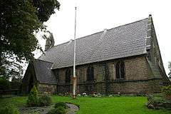 St John's Church, Shuttleworth | |
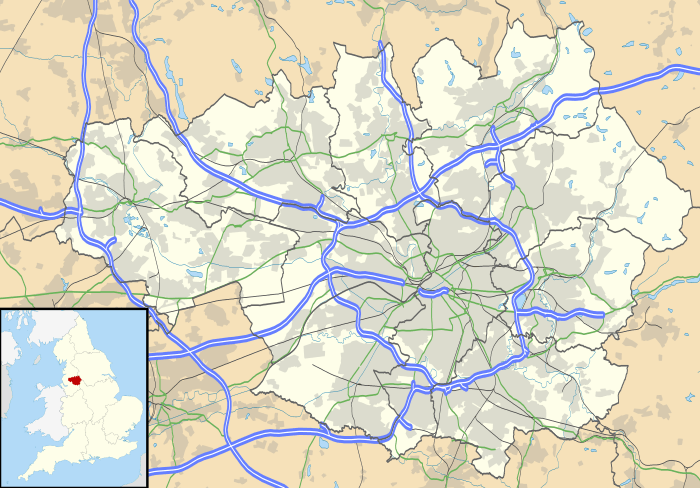 Shuttleworth Shuttleworth shown within Greater Manchester | |
| OS grid reference | SD805175 |
| • London | 174 mi (280 km) SSE |
| Metropolitan borough | |
| Metropolitan county | |
| Region | |
| Country | England |
| Sovereign state | United Kingdom |
| Post town | BURY |
| Postcode district | BL0 |
| Dialling code | 01706 |
| Police | Greater Manchester |
| Fire | Greater Manchester |
| Ambulance | North West |
| EU Parliament | North West England |
| UK Parliament | |
Shuttleworth is a hamlet at the northeastern extremity of the Metropolitan Borough of Bury, in Greater Manchester, England.[1][2] It lies amongst the South Pennines, 4.3 miles (6.9 km) north of Bury and 0.9 miles (1.4 km) south of Edenfield; Scout Moor Wind Farm lies to the immediate east. Effectively a suburb of Ramsbottom, the M66 motorway divides Shuttleworth from the main core of that town.
Historically a part of Lancashire, the name Shuttleworth derives from the Old English scyttels and worth meaning a gated enclosure. The first element refers to a bar. It was documented as Suttelsworth in 1227 and Shuttelesworthe in 1296.[3]
During the Middle Ages, Shuttleworth lay within the township of Walmersley (sometimes called Walmersley-cum-Shuttleworth), parish of Bury, and hundred of Salford. Following the Local Government Act 1894, the area became a civil parish, but in 1933 was dissolved and amalgamated into the Ramsbottom Urban District.[1]
Shuttleworth is bounded to the south by Holcombe Brook and Summerseat; to the north by Edenfield, Irwell Vale; to the west by Holcombe and Ramsbottom and to the east by Stubbins, Turn Village and Shuttleworth-cum-Turn.
References
| Wikimedia Commons has media related to Shuttleworth, Greater Manchester. |
Notes
- 1 2 Greater Manchester Gazetteer, Greater Manchester County Record Office, Places names - S, archived from the original on 18 July 2011, retrieved 17 June 2008
- ↑ Ordnance Survey, Source data - 1:25,000 Scale Colour Raster; Grid reference at centre — SD 805 175 GB Grid, getamap.ordnancesurvey.co.uk, retrieved 3 November 2008
- ↑ Mills 1976, p. 133
Bibliography
- Mills, David (1976), The Place-Names of Lancashire, B.T. Batsford, ISBN 0-7134-3248-9