Sherry (community), Wisconsin
| Sherry, Wisconsin | |
|---|---|
| Unincorporated community | |
 Sherry, Wisconsin  Sherry, Wisconsin | |
| Coordinates: 44°35′03″N 89°54′56″W / 44.58417°N 89.91556°WCoordinates: 44°35′03″N 89°54′56″W / 44.58417°N 89.91556°W | |
| Country | United States |
| State | Wisconsin |
| County | Wood |
| Elevation | 1,148 ft (350 m) |
| Time zone | UTC-6 (Central (CST)) |
| • Summer (DST) | UTC-5 (CDT) |
| Area code(s) | 715 & 534 |
| GNIS feature ID | 1574037[1] |
Sherry is an unincorporated community located in the town of Sherry, Wood County, Wisconsin, United States. Sherry is located at the junction of County Highways N and F 3.5 miles (5.6 km) west-southwest of Milladore.[2]
History
Sherry was platted in 1899, and named after Henry Sherry, proprietor of a local sawmill.[3] A post office called Sherry was established in 1884, and remained in operation until 1968.[4]
References
- ↑ U.S. Geological Survey Geographic Names Information System: Sherry (community), Wisconsin
- ↑ Wood County (PDF) (Map). Wisconsin Department of Transportation. Archived from the original (pdf) on May 16, 2008. Retrieved July 17, 2011.
- ↑ Rudolph, Robert S. (1970). Wood County Place Names (PDF). The University of Wisconsin Press. p. 76.
- ↑ "Post Offices". Jim Forte Postal History. Retrieved 27 March 2018.
External links
Municipalities and communities of Wood County, Wisconsin, United States | ||
|---|---|---|
| Cities | 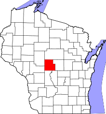 | |
| Villages | ||
| Towns | ||
| CDPs | ||
| Unincorporated communities | ||
| Indian reservation | ||
| Footnotes | ‡This populated place also has portions in an adjacent county or counties | |
This article is issued from
Wikipedia.
The text is licensed under Creative Commons - Attribution - Sharealike.
Additional terms may apply for the media files.