Babcock, Wisconsin
| Babcock, Wisconsin | |
|---|---|
| Census-designated place | |
 Sign on WIS 173 | |
 Babcock, Wisconsin | |
| Coordinates: 44°18′06″N 90°06′40″W / 44.30167°N 90.11111°WCoordinates: 44°18′06″N 90°06′40″W / 44.30167°N 90.11111°W | |
| Country | United States |
| State | Wisconsin |
| County | Wood |
| Area | |
| • Total | 3.101 sq mi (8.03 km2) |
| • Land | 3.101 sq mi (8.03 km2) |
| • Water | 0 sq mi (0 km2) |
| Elevation | 974 ft (297 m) |
| Population (2010) | |
| • Total | 126 |
| • Density | 41/sq mi (16/km2) |
| Time zone | UTC-6 (Central (CST)) |
| • Summer (DST) | UTC-5 (CDT) |
| ZIP code | 54413 |
| Area code(s) | 715 & 534 |
| GNIS feature ID | 1561050[1] |
Babcock is an unincorporated census-designated place located in Wood County, Wisconsin, United States. Babcock is southwest of Wisconsin Rapids, in the town of Remington. Babcock has a post office with ZIP code 54413.[2] As of the 2010 census, its population is 126.[3] Its motto is "Birds, Bogs, and Bucks." The community was named for Joseph W. Babcock, a sawmill operator who purchased the site and built a hotel and a depot.[4][5]
Babcock was once an important junction on the Milwaukee Road, with lines running north, east, south, and southwest. Today, however, only a single track of the Canadian National runs south to Necedah and east to Port Edwards and Wisconsin Rapids.
Images
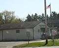 Post office
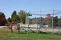 Baseball diamond
References
| Wikimedia Commons has media related to Babcock, Wisconsin. |
- ↑ U.S. Geological Survey Geographic Names Information System: Babcock, Wisconsin
- ↑ ZIP Code Lookup
- ↑ "American FactFinder". U.S. Census Bureau. Archived from the original on 23 April 2011. Retrieved 29 March 2011.
- ↑ Callary, Edward. Place Names of Wisconsin. Madison, WI: University of Wisconsin Press. p. 18. ISBN 978-0-299-30964-0.
- ↑ Rudolph, Robert S. (1970). Wood County Place Names. The University of Wisconsin Press. p. 6.
External links
Municipalities and communities of Wood County, Wisconsin, United States | ||
|---|---|---|
| Cities | 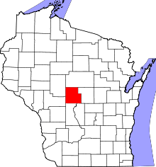 | |
| Villages | ||
| Towns | ||
| CDPs | ||
| Unincorporated communities | ||
| Indian reservation | ||
| Footnotes | ‡This populated place also has portions in an adjacent county or counties | |
This article is issued from
Wikipedia.
The text is licensed under Creative Commons - Attribution - Sharealike.
Additional terms may apply for the media files.