Sherman Township, Huron County, Ohio
| Sherman Township, Huron County, Ohio | |
|---|---|
| Township | |
 St. Sebastian's Catholic Church at Bismarck | |
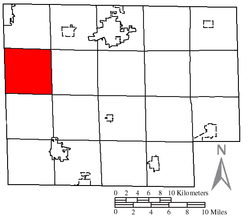 Location of Sherman Township in Huron County | |
| Coordinates: 41°11′1″N 82°46′49″W / 41.18361°N 82.78028°WCoordinates: 41°11′1″N 82°46′49″W / 41.18361°N 82.78028°W | |
| Country | United States |
| State | Ohio |
| County | Huron |
| Area | |
| • Total | 26.0 sq mi (67.3 km2) |
| • Land | 25.9 sq mi (67.0 km2) |
| • Water | 0.1 sq mi (0.3 km2) |
| Elevation[1] | 801 ft (244 m) |
| Population (2010) | |
| • Total | 510 |
| • Density | 20/sq mi (7.6/km2) |
| Time zone | UTC-5 (Eastern (EST)) |
| • Summer (DST) | UTC-4 (EDT) |
| FIPS code | 39-72193[2] |
| GNIS feature ID | 1086359[1] |
Sherman Township is one of the nineteen townships of Huron County, Ohio, United States. As of the 2010 census the population of the township was 510.[3]
Geography
Located on the western edge of the county, it borders the following townships:
- Lyme Township - north
- Ridgefield Township - northeast corner
- Peru Township - east
- Greenfield Township - southeast corner
- Norwich Township - south
- Reed Township, Seneca County - southwest
- Thompson Township, Seneca County - northwest
No municipalities are located in Sherman Township.
Name and history
Sherman Township was named for Taylor Sherman, a director of the Firelands company.[4]
It is the only Sherman Township statewide.[5]
Government
The township is governed by a three-member board of trustees, who are elected in November of odd-numbered years to a four-year term beginning on the following January 1. Two are elected in the year after the presidential election and one is elected in the year before it. There is also an elected township fiscal officer,[6] who serves a four-year term beginning on April 1 of the year after the election, which is held in November of the year before the presidential election. Vacancies in the fiscal officership or on the board of trustees are filled by the remaining trustees.
References
- 1 2 "US Board on Geographic Names". United States Geological Survey. 2007-10-25. Retrieved 2008-01-31.
- ↑ "American FactFinder". United States Census Bureau. Retrieved 2008-01-31.
- ↑ "Geographic Identifiers: 2010 Census Summary File 1 (G001): Sherman township, Huron County, Ohio". American Factfinder. U.S. Census Bureau. Retrieved January 12, 2018.
- ↑ Baughman, Abraham J. (1909). History of Huron County, Ohio: Its Progress and Development, with Biographical Sketches of Prominent Citizens of the County, Volume 1. S. J. Clarke Publishing Company. p. 268.
- ↑ "Detailed map of Ohio" (PDF). United States Census Bureau. 2000. Retrieved 2007-02-16.
- ↑ §503.24, §505.01, and §507.01 of the Ohio Revised Code. Accessed 4/30/2009.
External links
Municipalities and communities of Huron County, Ohio, United States | ||
|---|---|---|
| Cities | 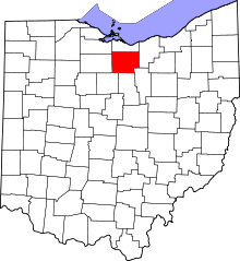 | |
| Villages | ||
| Townships | ||
| CDPs | ||
| Unincorporated communities | ||
| Footnotes | ‡This populated place also has portions in an adjacent county or counties | |