Shelbiana, Kentucky
| Shelbiana, Kentucky | |
|---|---|
| Unincorporated community | |
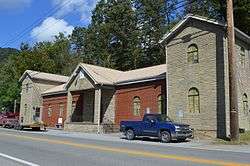 Former church on U.S. Route 460 | |
 Shelbiana, Kentucky Location within the state of Kentucky  Shelbiana, Kentucky Shelbiana, Kentucky (the US) | |
| Coordinates: 37°25′31″N 82°29′35″W / 37.42528°N 82.49306°WCoordinates: 37°25′31″N 82°29′35″W / 37.42528°N 82.49306°W | |
| Country | United States |
| State | Kentucky |
| County | Pike |
| Elevation | 810 ft (250 m) |
| Time zone | UTC-6 (Eastern (EST)) |
| • Summer (DST) | UTC-5 (CST) |
| ZIP codes | 41562 |
| GNIS feature ID | 503312[1] |
Shelbiana is an unincorporated community and coal town in Pike County, Kentucky, United States.
References

This article is issued from
Wikipedia.
The text is licensed under Creative Commons - Attribution - Sharealike.
Additional terms may apply for the media files.